Europe at night
Bildnummer 11632382
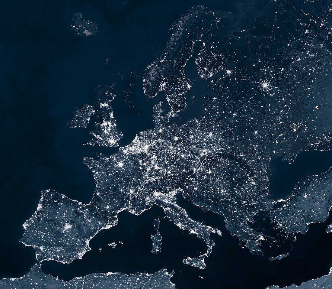
| Europe at night. Map showing urban and industrial lights over Europe at night. It was created by combining data from NASA's Moderate Resolution Imaging Spectroradiometer (MODIS) aboard the Terra satellite. Most lights originate from artificial lighting in cities and towns. Smaller groups of lights are visible in the North Sea which originate from oil rig gas flares. This image illustrates modern human impact on the planet | |
| Lizenzart: | Lizenzpflichtig |
| Credit: | Science Photo Library / Pharand-Deschenes, Felix |
| Bildgröße: | 3212 px × 2791 px |
| Modell-Rechte: | nicht erforderlich |
| Eigentums-Rechte: | nicht erforderlich |
| Restrictions: | - |
Preise für dieses Bild ab 15 €
Universitäten & Organisationen
(Informationsmaterial Digital, Informationsmaterial Print, Lehrmaterial Digital etc.)
ab 15 €
Redaktionell
(Bücher, Bücher: Sach- und Fachliteratur, Digitale Medien (redaktionell) etc.)
ab 30 €
Werbung
(Anzeigen, Aussenwerbung, Digitale Medien, Fernsehwerbung, Karten, Werbemittel, Zeitschriften etc.)
ab 55 €
Handelsprodukte
(bedruckte Textilie, Kalender, Postkarte, Grußkarte, Verpackung etc.)
ab 75 €
Pauschalpreise
Rechtepakete für die unbeschränkte Bildnutzung in Print oder Online
ab 495 €
Keywords
- 21. Jahrhundert,
- Anthropozän,
- Erdbeobachtung,
- Erde,
- Eurasien,
- Eurasisch,
- Europa,
- europäisch,
- geografisch,
- Geographie,
- Illustration,
- Kunstwerk,
- Licht,
- menschliche Präsenz,
- modern,
- Modernität,
- modis,
- Nachtzeit,
- Ölbohrinsel,
- Planet,
- Satellit,
- Satellitenbild,
- Spektroradiometer,
- Stadt,
- Stadt in der Nacht,
- Städte,
- Urbanisierung,
- Vereinigtes Königreich,
- Welt in der Nacht