Gulf of Mexico coast,satellite image
Bildnummer 11630385
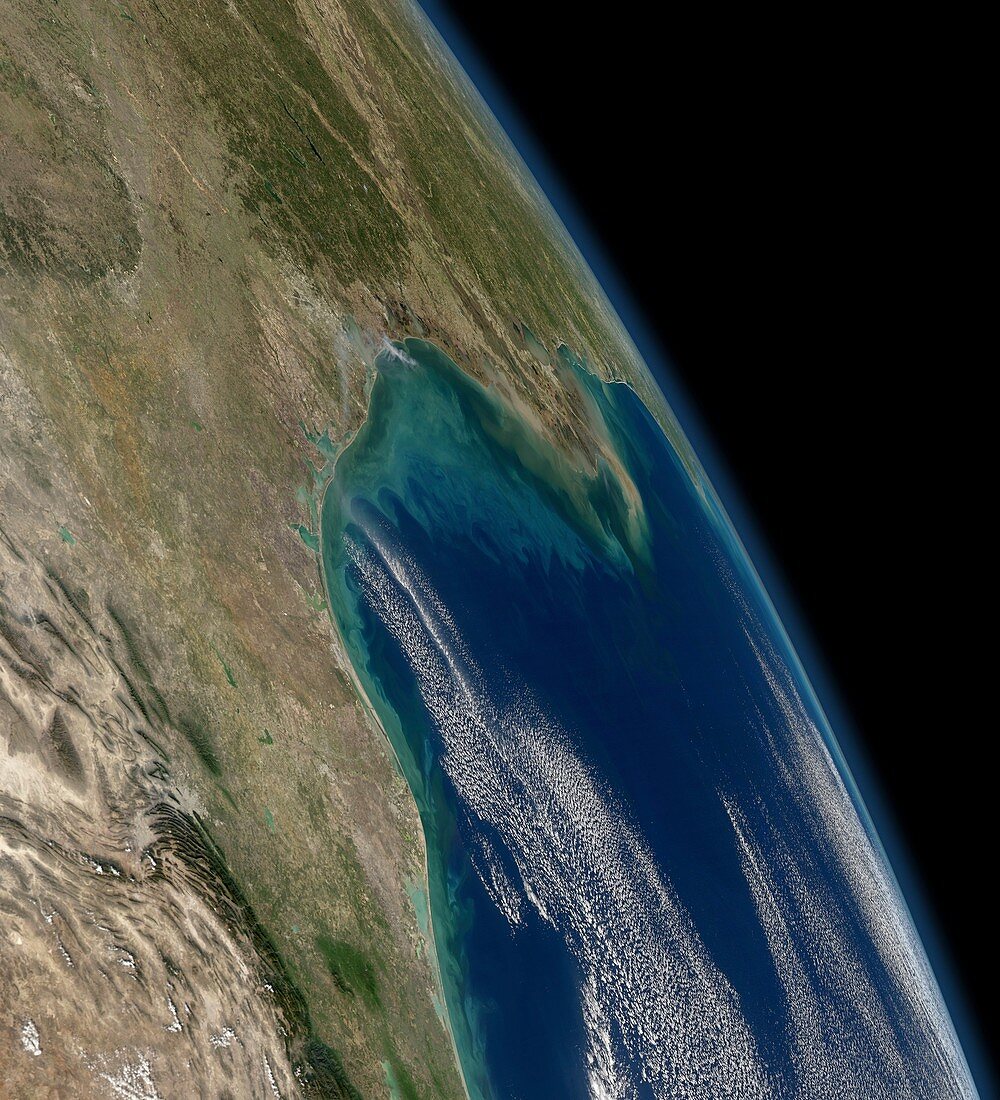
| Gulf of Mexico coast,satellite image. North is towards upper left. Clouds are white. The Mississippi River,flowing south,enters the Gulf of Mexico at New Orleans,Louisiana,USA,at upper centre. This river annually discharges 500 million tons of sediment into the Gulf,producing these swirling colours. This coastline stretches for over a thousand kilometres from the Texas and Mexico (lower left),eastwards to Florida (horizon,centre right). Image data obtained on 3 January 2012,by the Moderate-resolution Imaging Spectroradiometer (MODIS) instrument on NASA's Aqua satellite,part of the Earth Observing System (EOS) | |
| Lizenzart: | Lizenzpflichtig |
| Credit: | Science Photo Library / NASA |
| Bildgröße: | 4013 px × 4414 px |
| Modell-Rechte: | nicht erforderlich |
| Eigentums-Rechte: | nicht erforderlich |
| Restrictions: | - |
Preise für dieses Bild ab 15 €
Universitäten & Organisationen
(Informationsmaterial Digital, Informationsmaterial Print, Lehrmaterial Digital etc.)
ab 15 €
Redaktionell
(Bücher, Bücher: Sach- und Fachliteratur, Digitale Medien (redaktionell) etc.)
ab 30 €
Werbung
(Anzeigen, Aussenwerbung, Digitale Medien, Fernsehwerbung, Karten, Werbemittel, Zeitschriften etc.)
ab 55 €
Handelsprodukte
(bedruckte Textilie, Kalender, Postkarte, Grußkarte, Verpackung etc.)
ab 75 €
Pauschalpreise
Rechtepakete für die unbeschränkte Bildnutzung in Print oder Online
ab 495 €
Keywords
- 2012,
- absondern,
- aqua,
- Belastung,
- Delta,
- Erdbeobachtung,
- Florida,
- geografisch,
- Geographie,
- Golf von Mexiko,
- Krümmung,
- Kurve,
- Küstenlinie,
- Land,
- Louisiana,
- Meer,
- Mexikaner,
- Mexiko,
- Mississippi,
- modis,
- Mündung,
- Natürliche Farbe,
- Nordamerika,
- nordamerikanisch,
- optisch,
- Ozean,
- Phytoplankton,
- Satellit,
- Satellitenbild,
- Sichtbar,
- Texas,
- uns,
- USA,
- Vereinigte Staaten,
- Weltall,
- Wolke,
- Wolken