CryoSat-2 satellite,artwork
Bildnummer 11618136
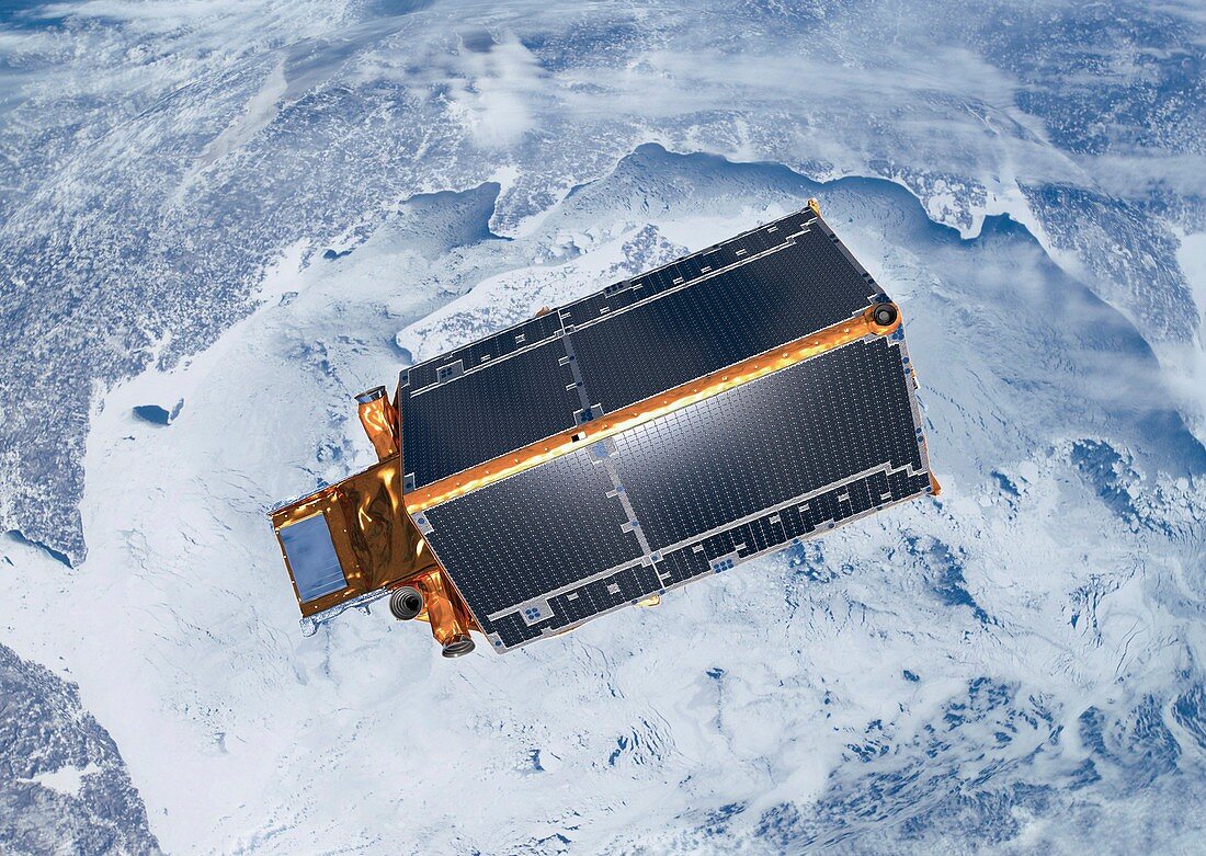
| CryoSat-2 satellite. Computer artwork of the European Space Agency's CryoSat-2 satellite in orbit over the Earth's polar regions. Cryosat-2 was launched on 8th April 2010 to replace the original CryoSat,which crashed due to a launch failure in October 2005. The satellite carries the Synthetic Aperture Interferometric Radar Altimeter (SIRAL) and is intended to measure,and then monitor,changes in the thickness of marine ice floating in the polar oceans and variations in the thickness of the vast ice sheets that overlie Greenland and Antarctica,in an effort to determine the effects of global warming | |
| Lizenzart: | Lizenzpflichtig |
| Credit: | Science Photo Library / ESA / AOES Medialab |
| Bildgröße: | 3000 px × 2130 px |
| Modell-Rechte: | nicht erforderlich |
| Restrictions: |
|
Preise für dieses Bild ab 15 €
Universitäten & Organisationen
(Informationsmaterial Digital, Informationsmaterial Print, Lehrmaterial Digital etc.)
ab 15 €
Redaktionell
(Bücher, Bücher: Sach- und Fachliteratur, Digitale Medien (redaktionell) etc.)
ab 30 €
Werbung
(Anzeigen, Aussenwerbung, Digitale Medien, Fernsehwerbung, Karten, Werbemittel, Zeitschriften etc.)
ab 55 €
Handelsprodukte
(bedruckte Textilie, Kalender, Postkarte, Grußkarte, Verpackung etc.)
ab 75 €
Pauschalpreise
Rechtepakete für die unbeschränkte Bildnutzung in Print oder Online
ab 495 €
Keywords
- 2010,
- 21. Jahrhundert,
- Auswirkungen,
- Dach,
- Effekt,
- einer,
- Erdbeobachtung,
- Erde,
- Erkundung,
- Ersatz,
- esa,
- Europäische Weltraumbehörde,
- Forschung,
- Globale Erwärmung,
- Illustration,
- Klima,
- Klimatologie,
- klimatologisch,
- Kunstwerk,
- Maschine,
- Messung,
- Meteorologie,
- meteorologisch,
- Mission,
- Orbit,
- Paneele,
- Photovoltaik,
- pv,
- Raum,
- Satellit,
- Single,
- solarbetrieben,
- Sonnenkollektor,
- Technologie,
- technologisch,
- Überwachung,
- umkreisend,
- Veränderung,
- Von Oben,
- Weltraumflug,
- Wissenschaft,
- wissenschaftlich,
- Zelle,
- Zellen