Global water vapour levels,July 2003
Bildnummer 11610763
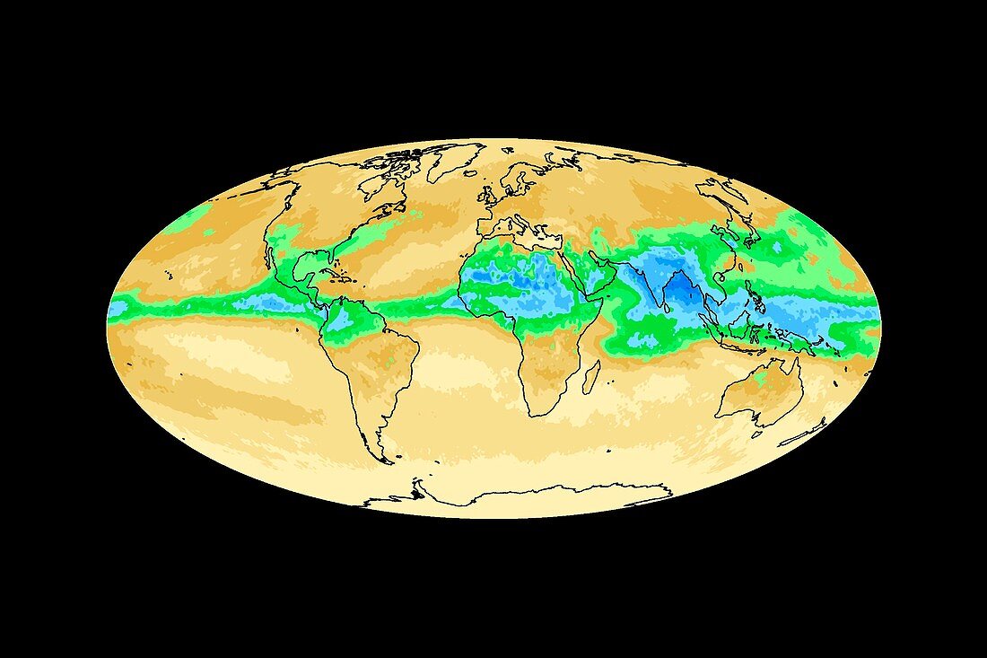
| Global water vapour levels. Map showing the mean clear air precipitable water (water vapour) in July 2003 2009 between 4.25 kilometres altitude and the top of the atmosphere. Low concentrations are beige,through brown,green and light blue to dark blue for higher concentrations. Concentrations are higher in the northern hemisphere,where it is summer. Data obtained using the Atmospheric Infrared Sounder (AIRS) instrument on the NASA Aqua Spacecraft | |
| Lizenzart: | Lizenzpflichtig |
| Credit: | Science Photo Library / NASA / JPL |
| Bildgröße: | 3633 px × 2421 px |
| Modell-Rechte: | nicht erforderlich |
| Eigentums-Rechte: | nicht erforderlich |
| Restrictions: | - |
Preise für dieses Bild ab 15 €
Universitäten & Organisationen
(Informationsmaterial Digital, Informationsmaterial Print, Lehrmaterial Digital etc.)
ab 15 €
Redaktionell
(Bücher, Bücher: Sach- und Fachliteratur, Digitale Medien (redaktionell) etc.)
ab 30 €
Werbung
(Anzeigen, Aussenwerbung, Digitale Medien, Fernsehwerbung, Karten, Werbemittel, Zeitschriften etc.)
ab 55 €
Handelsprodukte
(bedruckte Textilie, Kalender, Postkarte, Grußkarte, Verpackung etc.)
ab 75 €
Pauschalpreise
Rechtepakete für die unbeschränkte Bildnutzung in Print oder Online
ab 495 €