Antarctic Peninsula,satellite image
Bildnummer 11570979
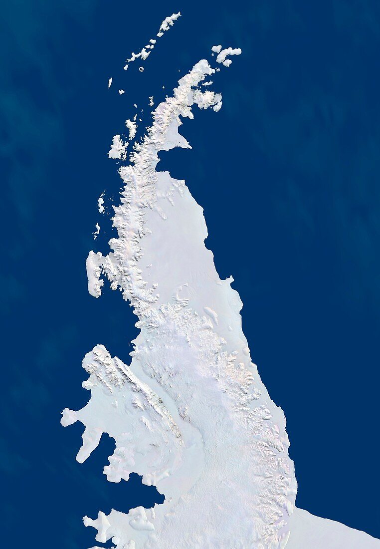
| Antarctic Peninsula,satellite image. This mountainous peninsula is flanked by the Larsen Ice Shelf to the east,and the Wilkins and George VI Ice Shelves to the west. The Larsen Ice Shelf suffered catastrophic collapses in 1995 and 2002. Based on satellite data assembled for International Polar Year (2007-2008),this image-map offers a recent snapshot of Antarctica's dynamic coastline. This image uses data from four satellite systems (see C004/566). The datasets used for this image were assembled for the International Polar Year (2007-2008) | |
| Lizenzart: | Lizenzpflichtig |
| Credit: | Science Photo Library / Planetary Visions |
| Bildgröße: | 3600 px × 5200 px |
| Modell-Rechte: | nicht erforderlich |
| Eigentums-Rechte: | nicht erforderlich |
| Restrictions: | - |
Preise für dieses Bild ab 15 €
Universitäten & Organisationen
(Informationsmaterial Digital, Informationsmaterial Print, Lehrmaterial Digital etc.)
ab 15 €
Redaktionell
(Bücher, Bücher: Sach- und Fachliteratur, Digitale Medien (redaktionell) etc.)
ab 30 €
Werbung
(Anzeigen, Aussenwerbung, Digitale Medien, Fernsehwerbung, Karten, Werbemittel, Zeitschriften etc.)
ab 55 €
Handelsprodukte
(bedruckte Textilie, Kalender, Postkarte, Grußkarte, Verpackung etc.)
ab 75 €
Pauschalpreise
Rechtepakete für die unbeschränkte Bildnutzung in Print oder Online
ab 495 €
Keywords
- 1,
- Antarktis,
- Antarktische Halbinsel,
- AVHRR,
- Berg,
- Berge,
- czcs,
- Eis,
- eisig,
- Erdbeobachtung,
- Gefroren,
- geografisch,
- Geographie,
- Halbinsel,
- Kalt,
- Küste,
- Küsten,
- Küsten-,
- Küstenlinie,
- Land,
- Meer,
- modis,
- Natur,
- Natürliche Farbe,
- polar,
- Regale,
- Region,
- Satellit,
- Satellitenbild,
- Schnee,
- Süd-,
- Südlicher Ozean,
- Wasser,
- Weltall,
- wolkenfrei,
- wolkenlos