The Arctic,satellite image
Bildnummer 11555397
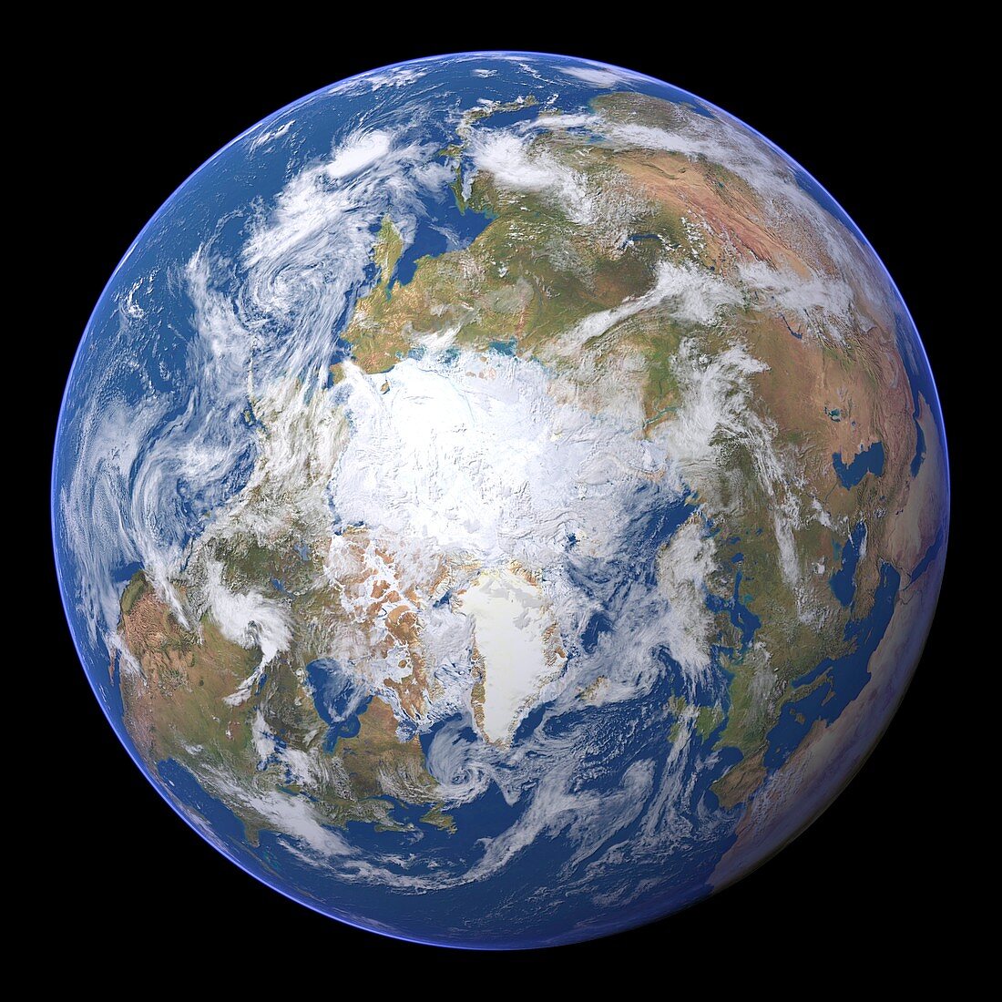
| The Arctic. Satellite image of the Earth centred on the Arctic. The North Pole is at centre. Clouds and Arctic sea ice are white,oceans are blue and land is green and brown. Also seen are Asia (upper right),Europe (lower right),the Atlantic Ocean (bottom),North America (lower left) and the Pacific Ocean (upper left). This image was produced by combining data from the Defense Meteorological Satellite Program (DMSP),NOAA's POES and Nimbus 7 satellites and the MODIS instrument on board NASA's Terra satellite | |
| Lizenzart: | Lizenzpflichtig |
| Credit: | Science Photo Library / Planetary Visions |
| Bildgröße: | 4193 px × 4193 px |
| Modell-Rechte: | nicht erforderlich |
| Eigentums-Rechte: | nicht erforderlich |
| Restrictions: | - |
Preise für dieses Bild ab 15 €
Universitäten & Organisationen
(Informationsmaterial Digital, Informationsmaterial Print, Lehrmaterial Digital etc.)
ab 15 €
Redaktionell
(Bücher, Bücher: Sach- und Fachliteratur, Digitale Medien (redaktionell) etc.)
ab 30 €
Werbung
(Anzeigen, Aussenwerbung, Digitale Medien, Fernsehwerbung, Karten, Werbemittel, Zeitschriften etc.)
ab 55 €
Handelsprodukte
(bedruckte Textilie, Kalender, Postkarte, Grußkarte, Verpackung etc.)
ab 75 €
Pauschalpreise
Rechtepakete für die unbeschränkte Bildnutzung in Print oder Online
ab 495 €
Keywords
- 21. Jahrhundert,
- Arktis,
- Asien,
- Atlantisch,
- ausgeschnitten,
- Ausschnitte,
- DMSP,
- eisig,
- Erdbeobachtung,
- Erde,
- Erdkunde,
- Europa,
- geografisch,
- Geographie,
- Globus,
- kombinierte Daten,
- Kontinent,
- Kontinente,
- Kreis,
- kreisförmig,
- Kugel,
- kugelförmig,
- Land,
- Meer,
- Meereis,
- modis,
- NASA,
- NOAA,
- Nordamerika,
- nördliche Hemisphäre,
- Nordpol,
- Ozean,
- Ozeane,
- Pazifik,
- Planet,
- planetarisch,
- POES,
- polar,
- Raum,
- Region,
- rund,
- Satellit,
- Satellitenbild,
- Schnee,
- Spektroradiometer,
- Tageszeit,
- Tagsüber,
- Terra,
- topografisch,
- Topographie,
- topographisch,
- Vegetation,
- Welt,
- Weltall,
- Wissenschaften,
- Wolke,
- Wolken,
- Wolkendecke,
- Wolkig