Greenland ice melt,2007
Bildnummer 11550618
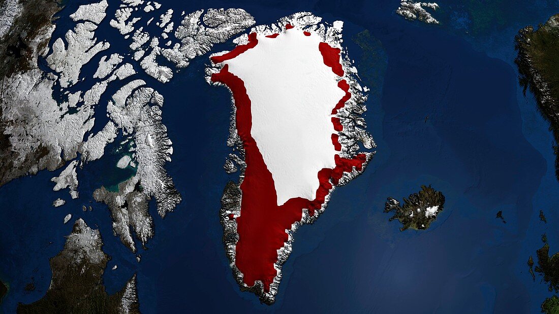
| Greenland ice melt,2007. The ice sheet melt extent is a daily estimate of the spatial extent of wet snow on the Greenland ice sheet,and is derived from passive microwave satellite brightness temperature measurements. This is representative of the amount of ice loss due to seasonal melting. This image shows (in red) the regions of the Greenland ice sheet over which melt occurred for more than three days in 2007 between 1 May and 30 September | |
| Lizenzart: | Lizenzpflichtig |
| Credit: | Science Photo Library / GSFC-SVS / NASA |
| Bildgröße: | 3946 px × 2220 px |
| Modell-Rechte: | nicht erforderlich |
| Eigentums-Rechte: | nicht erforderlich |
| Restrictions: | - |
Preise für dieses Bild ab 15 €
Universitäten & Organisationen
(Informationsmaterial Digital, Informationsmaterial Print, Lehrmaterial Digital etc.)
ab 15 €
Redaktionell
(Bücher, Bücher: Sach- und Fachliteratur, Digitale Medien (redaktionell) etc.)
ab 30 €
Werbung
(Anzeigen, Aussenwerbung, Digitale Medien, Fernsehwerbung, Karten, Werbemittel, Zeitschriften etc.)
ab 55 €
Handelsprodukte
(bedruckte Textilie, Kalender, Postkarte, Grußkarte, Verpackung etc.)
ab 75 €
Pauschalpreise
Rechtepakete für die unbeschränkte Bildnutzung in Print oder Online
ab 495 €