Earth from space,satellite image
Bildnummer 11550588
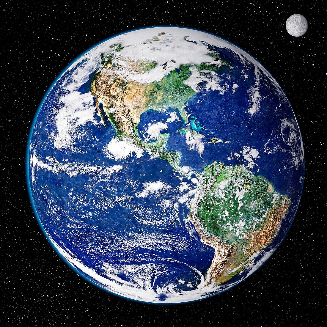
| Earth from space. Satellite image showing North and South America as seen from 35,000 kilometres above the Earth's surface. North is at top and the Moon is at upper right. Clouds (white) are seen,as are seas and oceans (blue). Land cover ranges from vegetation such as forests and grassy plains (green) to arid areas such as deserts,mountains,and scrublands (brown). This image combines data from the Moderate Resolution Imaging Spectroradiometer (MODIS) instrument aboard NASA's Terra satellite and NOAA's Geostationary Operational Environmental Satellite (GOES) | |
| Lizenzart: | Lizenzpflichtig |
| Credit: | Science Photo Library / NASA's Goddard Space Flight Center |
| Bildgröße: | 4200 px × 4200 px |
| Modell-Rechte: | nicht erforderlich |
| Eigentums-Rechte: | nicht erforderlich |
| Restrictions: | - |
Preise für dieses Bild ab 15 €
Universitäten & Organisationen
(Informationsmaterial Digital, Informationsmaterial Print, Lehrmaterial Digital etc.)
ab 15 €
Redaktionell
(Bücher, Bücher: Sach- und Fachliteratur, Digitale Medien (redaktionell) etc.)
ab 30 €
Werbung
(Anzeigen, Aussenwerbung, Digitale Medien, Fernsehwerbung, Karten, Werbemittel, Zeitschriften etc.)
ab 55 €
Handelsprodukte
(bedruckte Textilie, Kalender, Postkarte, Grußkarte, Verpackung etc.)
ab 75 €
Pauschalpreise
Rechtepakete für die unbeschränkte Bildnutzung in Print oder Online
ab 495 €
Keywords
- 21. Jahrhundert,
- Amerikanisch,
- Atlantisch,
- ausgeschnitten,
- Ausschnitte,
- Erdbeobachtung,
- Erde,
- geografisch,
- Geographie,
- Globus,
- Kontinent,
- Kontinente,
- Kreis,
- kreisförmig,
- Land,
- Meer,
- modis,
- Mond,
- NOAA,
- Nordamerika,
- Ozean,
- Ozeane,
- Pazifik,
- Planet,
- planetarisch,
- Raum,
- Regenwald,
- rund,
- Satellit,
- Satellitenbild,
- Sterne,
- Südamerika,
- Tageszeit,
- Tagsüber,
- Terra,
- trocken,
- Vegetation,
- Wald,
- Wälder,
- Wasser,
- Welt,
- Weltall,
- Wolke,
- Wolken,
- Wolkendecke,
- Wolkig,
- Wüste