Verulamium, UK, 3D LiDAR scan
Bildnummer 14179857
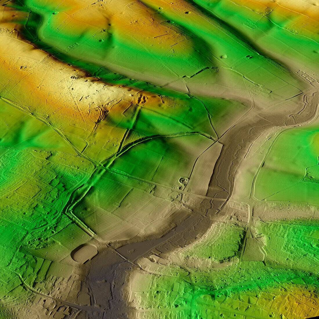
| 3D LiDAR model of Verulamium in St Albans, UK. The digital terrain model offers a view of the surrounding landscape without obstruction from foliage. This was one of the largest towns in Roman Britain. Its population is estimated to have been around 15, 000 to 20, 000 inhabitants at its peak. Now, the site is a park and agricultural land and a large portion remains unexcavated. Image contains UK public sector information licensed under the Open Government Licence v3.0. | |
| Lizenzart: | Lizenzpflichtig |
| Credit: | Science Photo Library / Terrey, Simon |
| Bildgröße: | 5905 px × 5905 px |
| Modell-Rechte: | nicht erforderlich |
| Eigentums-Rechte: | nicht erforderlich |
| Restrictions: | - |
Preise für dieses Bild ab 15 €
Universitäten & Organisationen
(Informationsmaterial Digital, Informationsmaterial Print, Lehrmaterial Digital etc.)
ab 15 €
Redaktionell
(Bücher, Bücher: Sach- und Fachliteratur, Digitale Medien (redaktionell) etc.)
ab 30 €
Werbung
(Anzeigen, Aussenwerbung, Digitale Medien, Fernsehwerbung, Karten, Werbemittel, Zeitschriften etc.)
ab 55 €
Handelsprodukte
(bedruckte Textilie, Kalender, Postkarte, Grußkarte, Verpackung etc.)
ab 75 €
Pauschalpreise
Rechtepakete für die unbeschränkte Bildnutzung in Print oder Online
ab 495 €
Keywords
- 3D,
- Alt,
- Alter,
- Archäologie,
- archäologisch,
- britisch,
- Defensive,
- Digitales Geländemodell,
- Dorf,
- dtm,
- Europa,
- europäisch,
- Geschichte,
- Großbritannien,
- historisch,
- Landschaft,
- Laser,
- Modell-,
- Modelling,
- Niemand,
- prähistorisch,
- Römisch,
- Scan,
- Siedlung,
- Stadt,
- Terrain,
- topografisch,
- Topographie,
- topographisch,
- Vereinigtes Königreich,
- Verteidigung,
- Vorgeschichte