Old Oswestry, UK, 3D LiDAR scan
Bildnummer 14179778
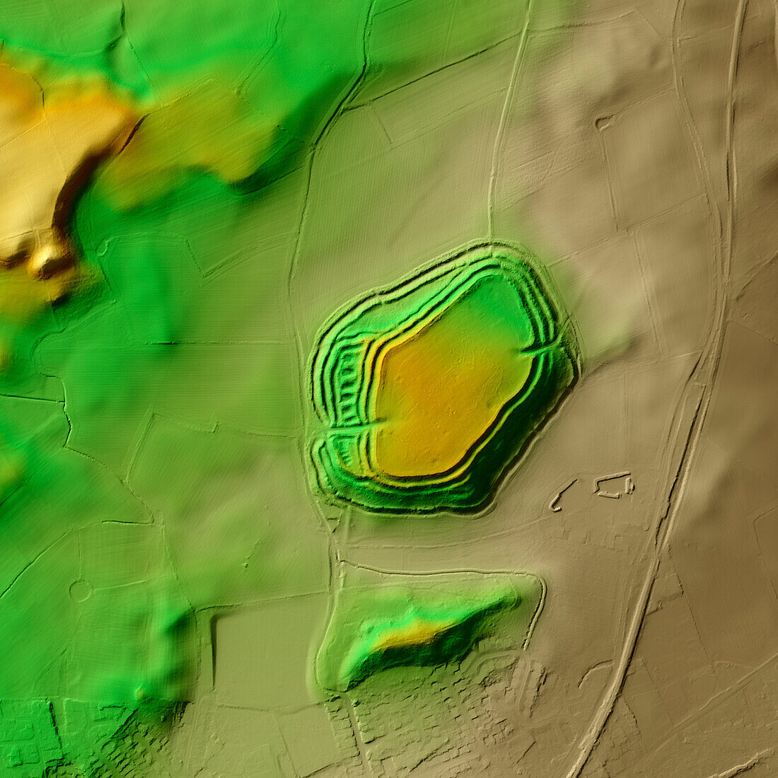
| 3D LiDAR model of Old Oswestry in Shropshire, UK. The digital terrain model offers a view of the surrounding landscape without obstruction from foliage. Old Oswestry was built and occupied during the Iron Age (800 BCE to 43 CE) and is one of the best-preserved hillforts in Britain. Hillforts were widely constructed across Britain and Ireland in the centuries leading up to the Roman conquest of these regions. This is a fine example of a 'multivallate' or multiple rampart hillfort. It remained in use for almost 1, 000 years. Image contains UK public sector information licensed under the Open Government Licence v3.0. | |
| Lizenzart: | Lizenzpflichtig |
| Credit: | Science Photo Library / Terrey, Simon |
| Bildgröße: | 5905 px × 5905 px |
| Modell-Rechte: | nicht erforderlich |
| Eigentums-Rechte: | nicht erforderlich |
| Restrictions: | - |
Preise für dieses Bild ab 15 €
Universitäten & Organisationen
(Informationsmaterial Digital, Informationsmaterial Print, Lehrmaterial Digital etc.)
ab 15 €
Redaktionell
(Bücher, Bücher: Sach- und Fachliteratur, Digitale Medien (redaktionell) etc.)
ab 30 €
Werbung
(Anzeigen, Aussenwerbung, Digitale Medien, Fernsehwerbung, Karten, Werbemittel, Zeitschriften etc.)
ab 55 €
Handelsprodukte
(bedruckte Textilie, Kalender, Postkarte, Grußkarte, Verpackung etc.)
ab 75 €
Pauschalpreise
Rechtepakete für die unbeschränkte Bildnutzung in Print oder Online
ab 495 €
Keywords
- 3D,
- Alt,
- Alter,
- Archäologie,
- archäologisch,
- Aussicht,
- britisch,
- Defensive,
- Digitales Geländemodell,
- dtm,
- England,
- Englisch,
- Europa,
- europäisch,
- Geschichte,
- Großbritannien,
- historisch,
- Hügel,
- Landschaft,
- Laser,
- Modell-,
- Modelling,
- Niemand,
- prähistorisch,
- Scan,
- shropshire,
- Siedlung,
- Terrain,
- topografisch,
- Topographie,
- topographisch,
- Vereinigtes Königreich,
- Verteidigung,
- Vorgeschichte,
- Wall