Blackdown Rings, UK, 3D LiDAR scan
Bildnummer 14179771
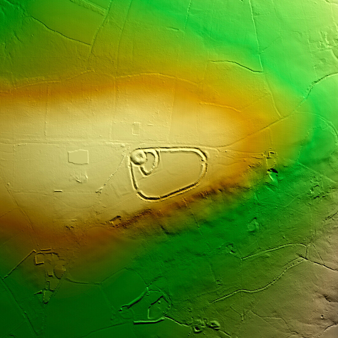
| 3D LiDAR model of Blackdown Rings, an Iron Age hillfort in Devon, UK. The digital terrain model offers a view of the surrounding landscape without obstruction from foliage. The hillfort consists of earthworks and remains of a medieval ringwork that includes an earth bank, which is 30 metres in diameter at the base, surrounded by a ditch. Hillforts were settlements built on natural hills, fortified with earthworks around the hill's contours. These were widely constructed across Britain and Ireland in the centuries leading up to the Roman conquest of these regions. Image contains UK public sector information licensed under the Open Government Licence v3.0. | |
| Lizenzart: | Lizenzpflichtig |
| Credit: | Science Photo Library / Terrey, Simon |
| Bildgröße: | 5905 px × 5905 px |
| Modell-Rechte: | nicht erforderlich |
| Eigentums-Rechte: | nicht erforderlich |
| Restrictions: | - |
Preise für dieses Bild ab 15 €
Universitäten & Organisationen
(Informationsmaterial Digital, Informationsmaterial Print, Lehrmaterial Digital etc.)
ab 15 €
Redaktionell
(Bücher, Bücher: Sach- und Fachliteratur, Digitale Medien (redaktionell) etc.)
ab 30 €
Werbung
(Anzeigen, Aussenwerbung, Digitale Medien, Fernsehwerbung, Karten, Werbemittel, Zeitschriften etc.)
ab 55 €
Handelsprodukte
(bedruckte Textilie, Kalender, Postkarte, Grußkarte, Verpackung etc.)
ab 75 €
Pauschalpreise
Rechtepakete für die unbeschränkte Bildnutzung in Print oder Online
ab 495 €
Keywords
- 3D,
- Alt,
- Alter,
- Archäologie,
- archäologisch,
- Aussicht,
- britisch,
- Defensive,
- Devon,
- Digitales Geländemodell,
- dtm,
- England,
- Englisch,
- Europa,
- europäisch,
- Geschichte,
- Großbritannien,
- historisch,
- Hügel,
- Landschaft,
- Laser,
- Modell-,
- Modelling,
- neolithisch,
- Niemand,
- prähistorisch,
- Scan,
- Siedlung,
- Terrain,
- topografisch,
- Topographie,
- topographisch,
- Vereinigtes Königreich,
- Verteidigung,
- Vorgeschichte