Forden Gaer, Wales, 3D LiDAR scan
Bildnummer 14179768
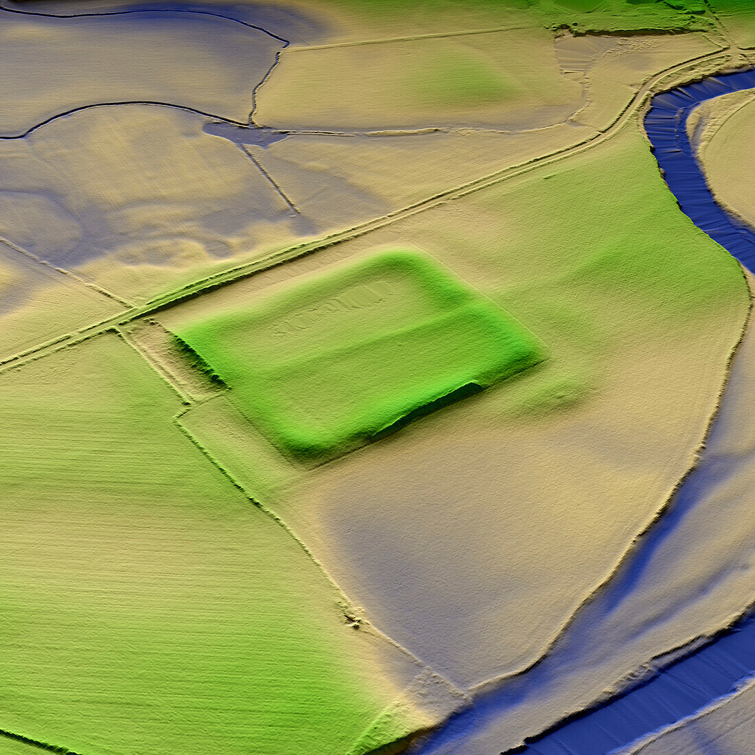
| 3D LiDAR model of Forden Gaer a Roman fort in Powys, Wales. The digital terrain model offers a view of the surrounding landscape without obstruction from foliage. The Roman settlement was established in the mid-1st century CE and was focused on a large earthwork enclosure. The fort was strategically built on the old Roman Road, which runs between Wroxeter and Caersws, and crosses the River Severn. Image contains UK public sector information licensed under the Open Government Licence v3.0. | |
| Lizenzart: | Lizenzpflichtig |
| Credit: | Science Photo Library / Terrey, Simon |
| Bildgröße: | 5905 px × 5905 px |
| Modell-Rechte: | nicht erforderlich |
| Eigentums-Rechte: | nicht erforderlich |
| Restrictions: | - |
Preise für dieses Bild ab 15 €
Universitäten & Organisationen
(Informationsmaterial Digital, Informationsmaterial Print, Lehrmaterial Digital etc.)
ab 15 €
Redaktionell
(Bücher, Bücher: Sach- und Fachliteratur, Digitale Medien (redaktionell) etc.)
ab 30 €
Werbung
(Anzeigen, Aussenwerbung, Digitale Medien, Fernsehwerbung, Karten, Werbemittel, Zeitschriften etc.)
ab 55 €
Handelsprodukte
(bedruckte Textilie, Kalender, Postkarte, Grußkarte, Verpackung etc.)
ab 75 €
Pauschalpreise
Rechtepakete für die unbeschränkte Bildnutzung in Print oder Online
ab 495 €
Keywords
- 3D,
- Alt,
- Alter,
- Archäologie,
- archäologisch,
- Aussicht,
- britisch,
- Defensive,
- Digitales Geländemodell,
- dtm,
- Europa,
- europäisch,
- Geschichte,
- Großbritannien,
- historisch,
- Landschaft,
- Laser,
- Modell-,
- Modelling,
- Niemand,
- Powys,
- prähistorisch,
- Römisch,
- Scan,
- Siedlung,
- Terrain,
- topografisch,
- Topographie,
- topographisch,
- Vereinigtes Königreich,
- Verteidigung,
- Vorgeschichte,
- Wales,
- Walisisch