Cissbury Ring, UK, 3D LiDAR scan
Bildnummer 14179763
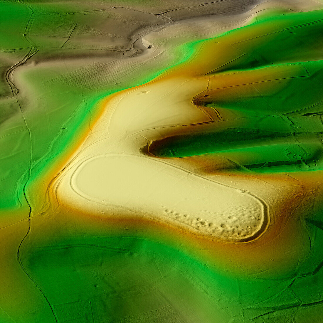
| 3D LiDAR scan of Cissbury Ring in West Sussex, UK. The digital terrain model offers a view of the surrounding landscape without obstruction from foliage. This is one of the largest hillforts of many found across the UK, covering an area of around 260, 000 square metres. It dates back to the Iron Age, over 2000 years ago. These hillforts are typically situated on hilltops and enclosed by earthworks such as ramparts and ditches. They served as fortified settlements or defensive structures for ancient communities, offering protection and control over the surrounding territory. Image contains UK public sector information licensed under the Open Government Licence v3.0. | |
| Lizenzart: | Lizenzpflichtig |
| Credit: | Science Photo Library / Terrey, Simon |
| Bildgröße: | 5905 px × 5905 px |
| Modell-Rechte: | nicht erforderlich |
| Eigentums-Rechte: | nicht erforderlich |
| Restrictions: | - |
Preise für dieses Bild ab 15 €
Universitäten & Organisationen
(Informationsmaterial Digital, Informationsmaterial Print, Lehrmaterial Digital etc.)
ab 15 €
Redaktionell
(Bücher, Bücher: Sach- und Fachliteratur, Digitale Medien (redaktionell) etc.)
ab 30 €
Werbung
(Anzeigen, Aussenwerbung, Digitale Medien, Fernsehwerbung, Karten, Werbemittel, Zeitschriften etc.)
ab 55 €
Handelsprodukte
(bedruckte Textilie, Kalender, Postkarte, Grußkarte, Verpackung etc.)
ab 75 €
Pauschalpreise
Rechtepakete für die unbeschränkte Bildnutzung in Print oder Online
ab 495 €
Keywords
- 3D,
- Alter,
- Archäologie,
- archäologisch,
- britisch,
- Digitales Geländemodell,
- Dreidimensional,
- dtm,
- England,
- Englisch,
- Europa,
- europäisch,
- Geschichte,
- Großbritannien,
- historisch,
- Hügel,
- Kultur,
- kulturell,
- Landschaft,
- Laser,
- Modell-,
- Modelling,
- Monument,
- Niemand,
- Plateau,
- prähistorisch,
- Scan,
- Terrain,
- topografisch,
- Topographie,
- topographisch,
- Vereinigtes Königreich,
- Vorgeschichte,
- Wall,
- West Sussex