Chichester Roman City Walls, UK, 3D LiDAR scan
Bildnummer 14179762
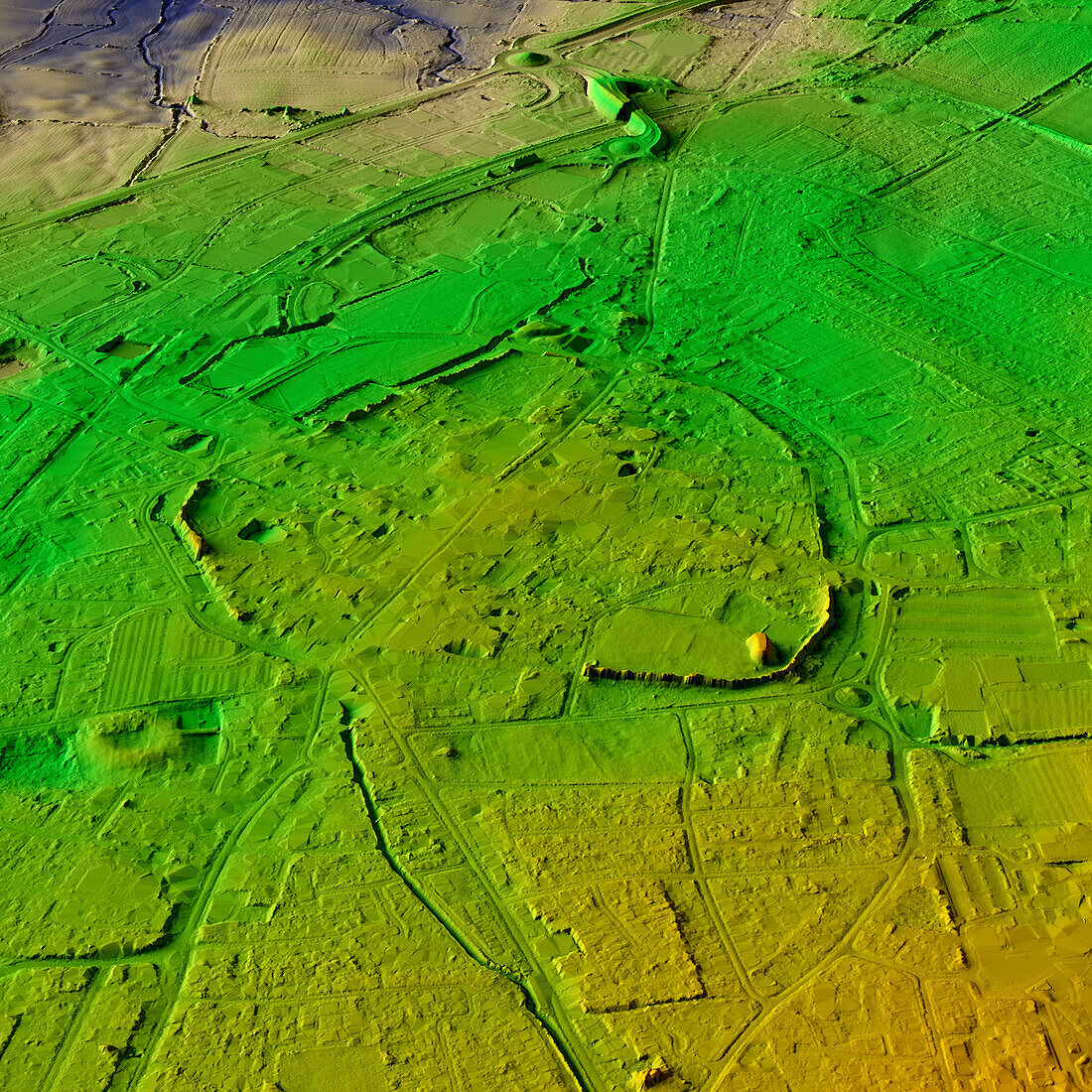
| 3D LiDAR model of Chichester Roman City Walls, in West Sussex, UK. The digital terrain model offers a view of the surrounding landscape without obstruction from foliage. Chichester was founded by the Romans in the 1st century CE. Constructed in the 3rd century CE, the walls enclosed an area of around 2.4 kilometres and featured defensive towers and gates. Four main Roman streets still define the shape of the city, and traces of the Roman forum, houses and public baths are visible in places. Image contains UK public sector information licensed under the Open Government Licence v3.0. | |
| Lizenzart: | Lizenzpflichtig |
| Credit: | Science Photo Library / Terrey, Simon |
| Bildgröße: | 5905 px × 5905 px |
| Modell-Rechte: | nicht erforderlich |
| Eigentums-Rechte: | nicht erforderlich |
| Restrictions: | - |
Preise für dieses Bild ab 15 €
Universitäten & Organisationen
(Informationsmaterial Digital, Informationsmaterial Print, Lehrmaterial Digital etc.)
ab 15 €
Redaktionell
(Bücher, Bücher: Sach- und Fachliteratur, Digitale Medien (redaktionell) etc.)
ab 30 €
Werbung
(Anzeigen, Aussenwerbung, Digitale Medien, Fernsehwerbung, Karten, Werbemittel, Zeitschriften etc.)
ab 55 €
Handelsprodukte
(bedruckte Textilie, Kalender, Postkarte, Grußkarte, Verpackung etc.)
ab 75 €
Pauschalpreise
Rechtepakete für die unbeschränkte Bildnutzung in Print oder Online
ab 495 €
Keywords
- 3D,
- Alt,
- Alter,
- Archäologie,
- archäologisch,
- Aussicht,
- britisch,
- Digitales Geländemodell,
- dtm,
- England,
- Englisch,
- Europa,
- europäisch,
- Geschichte,
- Großbritannien,
- historisch,
- Landschaft,
- Laser,
- Mauer,
- Modell-,
- Modelling,
- Niemand,
- prähistorisch,
- Römisch,
- Scan,
- Siedlung,
- Terrain,
- topografisch,
- Topographie,
- topographisch,
- Vereinigtes Königreich,
- Vorgeschichte,
- Wände