Berth Hill, UK, 3D LiDAR scan
Bildnummer 14179647
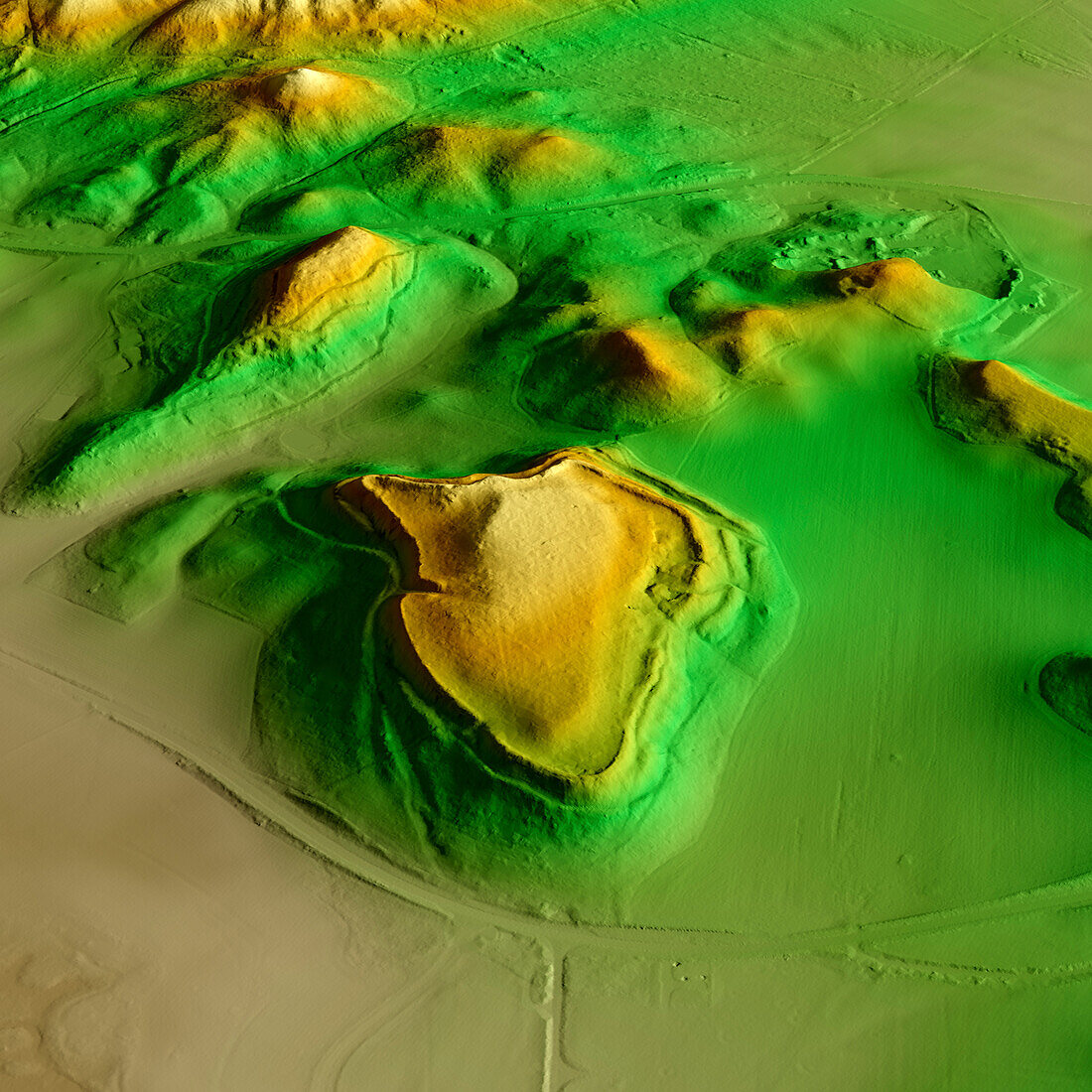
| 3D LiDAR scan of Berth Hill in Staffordshire, UK. The digital terrain model offers a view of the surrounding landscape without obstruction from foliage. This ancient hillfort is one of many hillforts found across the UK and dates back to the Iron Age, roughly between 800 BCE and 43 CE. Image contains UK public sector information licensed under the Open Government Licence v3.0. | |
| Lizenzart: | Lizenzpflichtig |
| Credit: | Science Photo Library / Terrey, Simon |
| Bildgröße: | 5905 px × 5905 px |
| Modell-Rechte: | nicht erforderlich |
| Eigentums-Rechte: | nicht erforderlich |
| Restrictions: | - |
Preise für dieses Bild ab 15 €
Universitäten & Organisationen
(Informationsmaterial Digital, Informationsmaterial Print, Lehrmaterial Digital etc.)
ab 15 €
Redaktionell
(Bücher, Bücher: Sach- und Fachliteratur, Digitale Medien (redaktionell) etc.)
ab 30 €
Werbung
(Anzeigen, Aussenwerbung, Digitale Medien, Fernsehwerbung, Karten, Werbemittel, Zeitschriften etc.)
ab 55 €
Handelsprodukte
(bedruckte Textilie, Kalender, Postkarte, Grußkarte, Verpackung etc.)
ab 75 €
Pauschalpreise
Rechtepakete für die unbeschränkte Bildnutzung in Print oder Online
ab 495 €
Keywords
- 3D,
- Alter,
- Archäologie,
- archäologisch,
- britisch,
- Digitales Geländemodell,
- Dreidimensional,
- dtm,
- England,
- Englisch,
- Europa,
- europäisch,
- Geschichte,
- Großbritannien,
- historisch,
- Hügel,
- Kultur,
- kulturell,
- Landschaft,
- Laser,
- Modell-,
- Modelling,
- Monument,
- Niemand,
- prähistorisch,
- Scan,
- Staffordshire,
- Terrain,
- topografisch,
- Topographie,
- topographisch,
- Vereinigtes Königreich,
- Vorgeschichte