Barbury Castle, UK, 3D LiDAR scan
Bildnummer 14179645
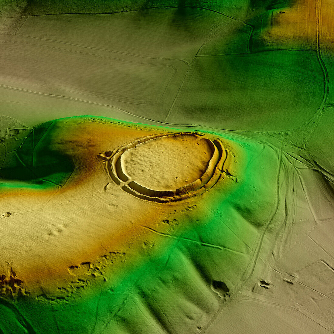
| 3D LiDAR scan of Barbury Castle in Wiltshire, UK. The digital terrain model offers a view of the surrounding landscape without obstruction from foliage. This ancient hillfort dates back to the Iron Age, roughly 2500 years ago. It is believed to have been occupied and used for defensive purposes. Image contains UK public sector information licensed under the Open Government Licence v3.0. | |
| Lizenzart: | Lizenzpflichtig |
| Credit: | Science Photo Library / Terrey, Simon |
| Bildgröße: | 5905 px × 5905 px |
| Modell-Rechte: | nicht erforderlich |
| Eigentums-Rechte: | nicht erforderlich |
| Restrictions: | - |
Preise für dieses Bild ab 15 €
Universitäten & Organisationen
(Informationsmaterial Digital, Informationsmaterial Print, Lehrmaterial Digital etc.)
ab 15 €
Redaktionell
(Bücher, Bücher: Sach- und Fachliteratur, Digitale Medien (redaktionell) etc.)
ab 30 €
Werbung
(Anzeigen, Aussenwerbung, Digitale Medien, Fernsehwerbung, Karten, Werbemittel, Zeitschriften etc.)
ab 55 €
Handelsprodukte
(bedruckte Textilie, Kalender, Postkarte, Grußkarte, Verpackung etc.)
ab 75 €
Pauschalpreise
Rechtepakete für die unbeschränkte Bildnutzung in Print oder Online
ab 495 €
Keywords
- 3D,
- Alter,
- Archäologie,
- archäologisch,
- britisch,
- Digitales Geländemodell,
- Dreidimensional,
- dtm,
- England,
- Englisch,
- Europa,
- europäisch,
- Geschichte,
- Großbritannien,
- historisch,
- Kultur,
- kulturell,
- Landschaft,
- Laser,
- Modell-,
- Modelling,
- Monument,
- Niemand,
- prähistorisch,
- Scan,
- Terrain,
- topografisch,
- Topographie,
- topographisch,
- Vereinigtes Königreich,
- Vorgeschichte,
- Wiltshire