Lunar South Pole terrain
Bildnummer 14166463
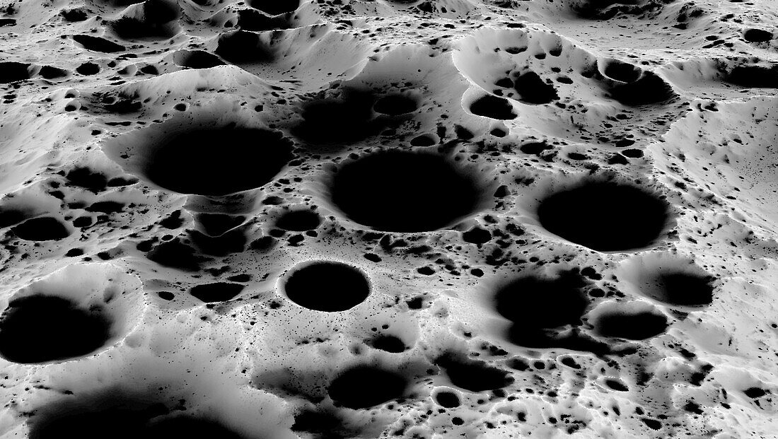
| Visualisation of the lunar South Pole terrain showing several craters such as Haworth, Shoemaker, and Faustini in the middle distance, and two massifs named Malapert and Leibnitz Beta in the background. The prominent Shackleton crater can also be seen at centre foreground. This area is of great significance to scientists due to the significant amounts of water ice detected in the permanently shadowed regions that never receive sunlight. Creating terrain maps is essential for human and robotic explorers who are scheduled to arrive at South Pole locations in 2024. Data was obtained by the Lunar Orbiter Laser Altimeter (LOLA) on the Lunar Reconnaissance Orbiter (LRO) satellite. | |
| Lizenzart: | Lizenzpflichtig |
| Credit: | Science Photo Library / NASA |
| Bildgröße: | 4317 px × 2437 px |
| Modell-Rechte: | nicht erforderlich |
| Eigentums-Rechte: | nicht erforderlich |
| Restrictions: | - |
Preise für dieses Bild ab 15 €
Universitäten & Organisationen
(Informationsmaterial Digital, Informationsmaterial Print, Lehrmaterial Digital etc.)
ab 15 €
Redaktionell
(Bücher, Bücher: Sach- und Fachliteratur, Digitale Medien (redaktionell) etc.)
ab 30 €
Werbung
(Anzeigen, Aussenwerbung, Digitale Medien, Fernsehwerbung, Karten, Werbemittel, Zeitschriften etc.)
ab 55 €
Handelsprodukte
(bedruckte Textilie, Kalender, Postkarte, Grußkarte, Verpackung etc.)
ab 75 €
Pauschalpreise
Rechtepakete für die unbeschränkte Bildnutzung in Print oder Online
ab 495 €