Mayotte, satellite image
Bildnummer 14113674
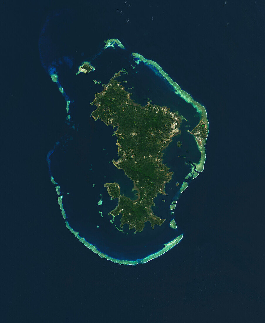
| Satellite image of the island Mayotte in the Mozambiqe Channel, Indian Ocean. Mayotte is a French territory between Madagascar and Mozambique. The capital city, Mamoudzou, spanning the north-east of Grand Terre (the main island) and Pamandzi (smaller island to the east) is visible, as are the coral reefs (light blue) which surround Mayotte, forming a lagoon. Image captured by the Operational Land Imager (OLI) on Landsat 8. | |
| Lizenzart: | Lizenzpflichtig |
| Credit: | Science Photo Library / NASA, Lauren Dauphin |
| Bildgröße: | 4254 px × 5183 px |
| Modell-Rechte: | nicht erforderlich |
| Eigentums-Rechte: | nicht erforderlich |
| Restrictions: | - |
Preise für dieses Bild ab 15 €
Universitäten & Organisationen
(Informationsmaterial Digital, Informationsmaterial Print, Lehrmaterial Digital etc.)
ab 15 €
Redaktionell
(Bücher, Bücher: Sach- und Fachliteratur, Digitale Medien (redaktionell) etc.)
ab 30 €
Werbung
(Anzeigen, Aussenwerbung, Digitale Medien, Fernsehwerbung, Karten, Werbemittel, Zeitschriften etc.)
ab 55 €
Handelsprodukte
(bedruckte Textilie, Kalender, Postkarte, Grußkarte, Verpackung etc.)
ab 75 €
Pauschalpreise
Rechtepakete für die unbeschränkte Bildnutzung in Print oder Online
ab 495 €