Lava flow on Mauna Loa, Hawaii, satellite image
Bildnummer 13754855
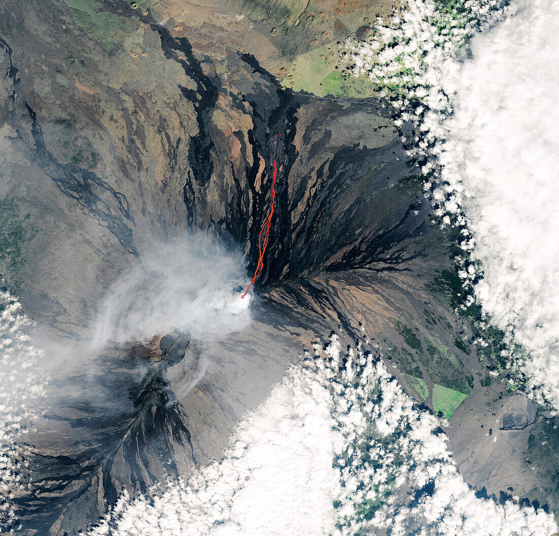
| Satellite image of a lava flow (red) on Mauna Loa, Hawaii, USA, on 2nd December 2022. On the 27th November 2022, the volcano began erupting for the first time since 1984. The lava flow seen here came from fissure 3, the dominant fissure. This flow, which measured more than 10 kilometres, was moving north and cut off the main road to the Mauna Loa Observatory (under clouds, centre left). Natural colour and infrared composite image obtained by the Operational Land Imager-2 (OLI-2) on the Landsat 9 satellite. | |
| Lizenzart: | Lizenzpflichtig |
| Credit: | Science Photo Library / US GEOLOGICAL SURVEY / NASA EARTH OBSERVATORY |
| Bildgröße: | 4279 px × 4100 px |
| Modell-Rechte: | nicht erforderlich |
| Eigentums-Rechte: | nicht erforderlich |
| Restrictions: | - |
Preise für dieses Bild ab 15 €
Universitäten & Organisationen
(Informationsmaterial Digital, Informationsmaterial Print, Lehrmaterial Digital etc.)
ab 15 €
Redaktionell
(Bücher, Bücher: Sach- und Fachliteratur, Digitale Medien (redaktionell) etc.)
ab 30 €
Werbung
(Anzeigen, Aussenwerbung, Digitale Medien, Fernsehwerbung, Karten, Werbemittel, Zeitschriften etc.)
ab 55 €
Handelsprodukte
(bedruckte Textilie, Kalender, Postkarte, Grußkarte, Verpackung etc.)
ab 75 €
Pauschalpreise
Rechtepakete für die unbeschränkte Bildnutzung in Print oder Online
ab 495 €