Theodore Roosevelt Bridge, aerial photograph
Bildnummer 13673636
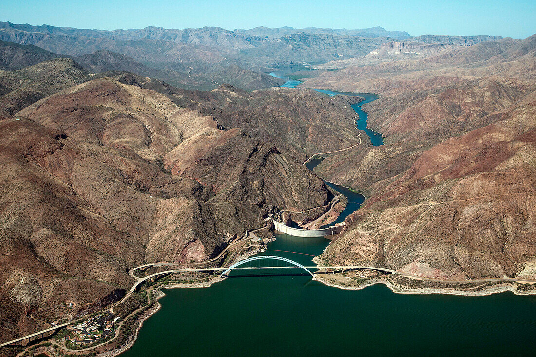
| Aerial photograph of Theodore Roosevelt Lake, bridge, dam, and the Salt River in the canyons below. This lake is in Tonto National Forest and mostly in Gila County, Arizona, USA. The Salt River is the largest tributary of the Gila River. Aerial support by LightHawk. | |
| Lizenzart: | Lizenzpflichtig |
| Credit: | Science Photo Library / Universal Images Group / Wild Horizon |
| Bildgröße: | 5500 px × 3670 px |
| Modell-Rechte: | nicht erforderlich |
| Eigentums-Rechte: | nicht erforderlich |
| Restrictions: | - |
Preise für dieses Bild ab 15 €
Universitäten & Organisationen
(Informationsmaterial Digital, Informationsmaterial Print, Lehrmaterial Digital etc.)
ab 15 €
Redaktionell
(Bücher, Bücher: Sach- und Fachliteratur, Digitale Medien (redaktionell) etc.)
ab 30 €
Werbung
(Anzeigen, Aussenwerbung, Digitale Medien, Fernsehwerbung, Karten, Werbemittel, Zeitschriften etc.)
ab 55 €
Handelsprodukte
(bedruckte Textilie, Kalender, Postkarte, Grußkarte, Verpackung etc.)
ab 75 €
Pauschalpreise
Rechtepakete für die unbeschränkte Bildnutzung in Print oder Online
ab 495 €