Ptolemy's map of Italy, 2nd century
Bildnummer 13633923
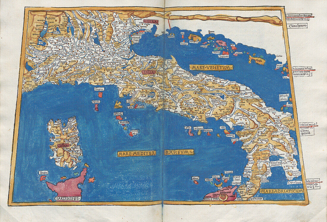
| Map of Italy and Corsica from an edition of Ptolemy's 'Geographia'. The text labels are in Latin, and this map is titled 'Tabula Prima Europae'. This 1482 atlas was a translation of Ptolemy's original work from Greek to Latin made in Ulm, Germany by Leinhart Holle. Claudius Ptolemaeus, also known as Ptolemy, was an astronomer and geographer who lived in the 2nd century in the Greek culture of Roman Egypt. Scotland is tilted to one side on this map. | |
| Lizenzart: | Lizenzpflichtig |
| Credit: | Science Photo Library / ALVIN |
| Bildgröße: | 7000 px × 4760 px |
| Modell-Rechte: | nicht erforderlich |
| Eigentums-Rechte: | nicht erforderlich |
| Restrictions: | - |
Preise für dieses Bild ab 15 €
Universitäten & Organisationen
(Informationsmaterial Digital, Informationsmaterial Print, Lehrmaterial Digital etc.)
ab 15 €
Redaktionell
(Bücher, Bücher: Sach- und Fachliteratur, Digitale Medien (redaktionell) etc.)
ab 30 €
Werbung
(Anzeigen, Aussenwerbung, Digitale Medien, Fernsehwerbung, Karten, Werbemittel, Zeitschriften etc.)
ab 55 €
Handelsprodukte
(bedruckte Textilie, Kalender, Postkarte, Grußkarte, Verpackung etc.)
ab 75 €
Pauschalpreise
Rechtepakete für die unbeschränkte Bildnutzung in Print oder Online
ab 495 €