Map of Marquisate and Third District of Brabant
Bildnummer 13503320
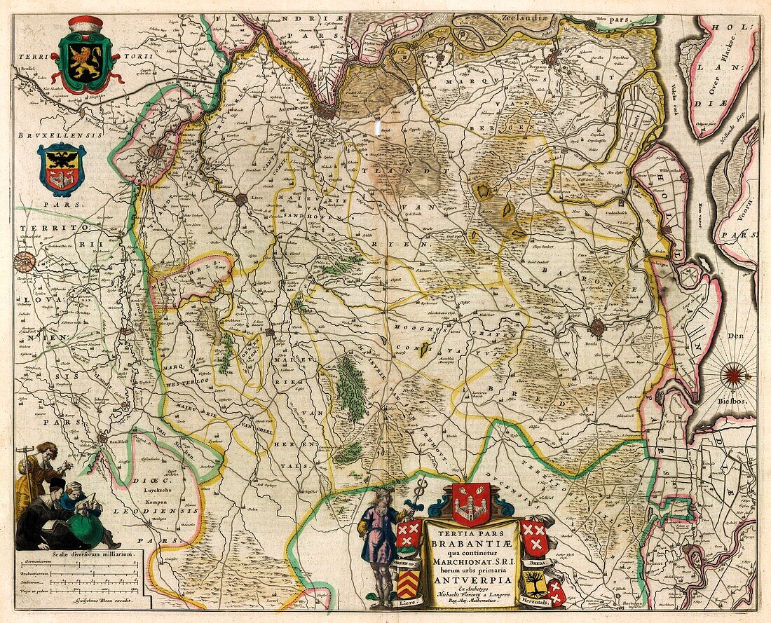
| 17th century illustrated map of Marquisate and Third District of Brabant. The Duchy of Brabant developed from the Landgraviate of Brabant and formed the heart of the historic Low Countries, part of the Burgundian Netherlands from 1430 and of the Habsburg Netherlands from 1482, until it was partitioned after the Dutch revolt. Today all the duchy's former territories, apart from exclaves, are in Belgium except for the Dutch province of North Brabant. Map from from 'Le theatre du monde' or 'Novvel atlas' (Amsterdam, 1647) by Dutch map-makers Willem Janszoon Blaeu (1571-1638) and Joan Blaeu (1596-1673). | |
| Lizenzart: | Lizenzpflichtig |
| Credit: | Science Photo Library / Library of Congress, Geography and Map Division |
| Bildgröße: | 6398 px × 5172 px |
| Modell-Rechte: | nicht erforderlich |
| Eigentums-Rechte: | nicht erforderlich |
| Restrictions: | - |
Preise für dieses Bild ab 15 €
Universitäten & Organisationen
(Informationsmaterial Digital, Informationsmaterial Print, Lehrmaterial Digital etc.)
ab 15 €
Redaktionell
(Bücher, Bücher: Sach- und Fachliteratur, Digitale Medien (redaktionell) etc.)
ab 30 €
Werbung
(Anzeigen, Aussenwerbung, Digitale Medien, Fernsehwerbung, Karten, Werbemittel, Zeitschriften etc.)
ab 55 €
Handelsprodukte
(bedruckte Textilie, Kalender, Postkarte, Grußkarte, Verpackung etc.)
ab 75 €
Pauschalpreise
Rechtepakete für die unbeschränkte Bildnutzung in Print oder Online
ab 495 €