Map of Alsace, 17th century
Bildnummer 13503318
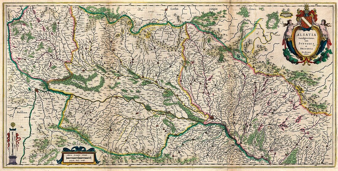
| 17th century illustrated map of Alsace from 'Le theatre du monde' or 'Novvel atlas' (Amsterdam, 1647) by Dutch map-makers Willem Janszoon Blaeu (1571-1638) and Joan Blaeu (1596-1673). Alsace is a territory in modern-day eastern France bordering Germany and Switzerland. | |
| Lizenzart: | Lizenzpflichtig |
| Credit: | Science Photo Library / Library of Congress, Geography and Map Division |
| Bildgröße: | 8310 px × 4205 px |
| Modell-Rechte: | nicht erforderlich |
| Eigentums-Rechte: | nicht erforderlich |
| Restrictions: | - |
Preise für dieses Bild ab 15 €
Universitäten & Organisationen
(Informationsmaterial Digital, Informationsmaterial Print, Lehrmaterial Digital etc.)
ab 15 €
Redaktionell
(Bücher, Bücher: Sach- und Fachliteratur, Digitale Medien (redaktionell) etc.)
ab 30 €
Werbung
(Anzeigen, Aussenwerbung, Digitale Medien, Fernsehwerbung, Karten, Werbemittel, Zeitschriften etc.)
ab 55 €
Handelsprodukte
(bedruckte Textilie, Kalender, Postkarte, Grußkarte, Verpackung etc.)
ab 75 €
Pauschalpreise
Rechtepakete für die unbeschränkte Bildnutzung in Print oder Online
ab 495 €