Topographical map of Hiroshima, Japan
Bildnummer 13474269
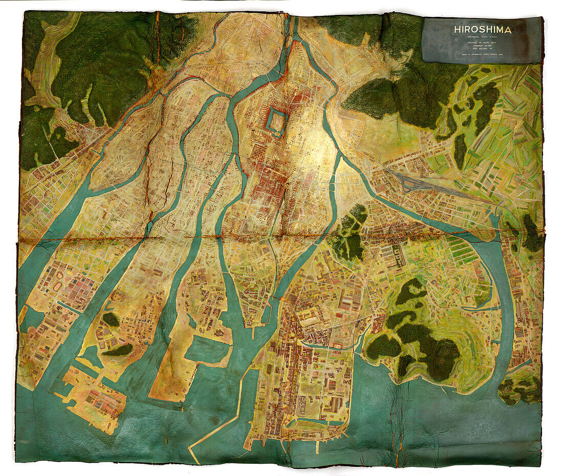
| Topographical map of Hiroshima, Japan, made for the United States Strategic Bombing Survey (USSBS). The map was created after a US bomber dropped the Little Boy atomic bomb on the city on 6th of August 1945. The bomb caused enormous destruction: killing over 140, 000 people. The USSBS report was produced to study the aerial effects of bombing carried out in German-occupied Europe and Japan during World War Two, as well as for the strategic future planning of the armed forces. | |
| Lizenzart: | Lizenzpflichtig |
| Credit: | Science Photo Library / National Archives and Records Administration |
| Bildgröße: | 6426 px × 5438 px |
| Modell-Rechte: | nicht erforderlich |
| Eigentums-Rechte: | nicht erforderlich |
| Restrictions: | - |
Preise für dieses Bild ab 15 €
Universitäten & Organisationen
(Informationsmaterial Digital, Informationsmaterial Print, Lehrmaterial Digital etc.)
ab 15 €
Redaktionell
(Bücher, Bücher: Sach- und Fachliteratur, Digitale Medien (redaktionell) etc.)
ab 30 €
Werbung
(Anzeigen, Aussenwerbung, Digitale Medien, Fernsehwerbung, Karten, Werbemittel, Zeitschriften etc.)
ab 55 €
Handelsprodukte
(bedruckte Textilie, Kalender, Postkarte, Grußkarte, Verpackung etc.)
ab 75 €
Pauschalpreise
Rechtepakete für die unbeschränkte Bildnutzung in Print oder Online
ab 495 €