Empty lakes after dams failed, USA, aerial photograph
Bildnummer 13445610
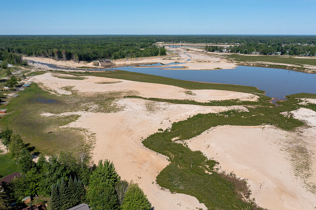
| Aerial photograph of the aftermath of 2020 flooding on the Tittabawassee River, which breached dams and drained Sanford and Wixom Lakes. The flooding was blamed on poorly-maintained infrastructure and heavier rains resulting from climate change. The flood breached an earthen dam (left), leaving a mostly dry lakebed. Everything below the tree line was Wixom Lake. Photographed in Edenville, Michigan, USA. | |
| Lizenzart: | Lizenzpflichtig |
| Credit: | Science Photo Library / West, Jim |
| Bildgröße: | 5270 px × 3510 px |
| Modell-Rechte: | nicht erforderlich |
| Eigentums-Rechte: | nicht erforderlich |
| Restrictions: | - |
Preise für dieses Bild ab 15 €
Universitäten & Organisationen
(Informationsmaterial Digital, Informationsmaterial Print, Lehrmaterial Digital etc.)
ab 15 €
Redaktionell
(Bücher, Bücher: Sach- und Fachliteratur, Digitale Medien (redaktionell) etc.)
ab 30 €
Werbung
(Anzeigen, Aussenwerbung, Digitale Medien, Fernsehwerbung, Karten, Werbemittel, Zeitschriften etc.)
ab 55 €
Handelsprodukte
(bedruckte Textilie, Kalender, Postkarte, Grußkarte, Verpackung etc.)
ab 75 €
Pauschalpreise
Rechtepakete für die unbeschränkte Bildnutzung in Print oder Online
ab 495 €