Western Europe at night, satellite image
Bildnummer 13297715
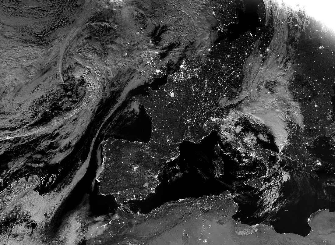
| Western Europe at night, satellite image. More densely populated areas are brighter. Data acquired by the day-night band of the Visible Infrared Imaging Radiometer Suite (VIIRS) on board the NASA-NOAA Suomi National Polar-orbiting Partnership (NPP) satellite, on 5th August 2020. | |
| Lizenzart: | Lizenzpflichtig |
| Credit: | Science Photo Library / NASA Earth Observatory |
| Bildgröße: | 5743 px × 4199 px |
| Modell-Rechte: | nicht erforderlich |
| Eigentums-Rechte: | nicht erforderlich |
| Restrictions: | - |
Preise für dieses Bild ab 15 €
Universitäten & Organisationen
(Informationsmaterial Digital, Informationsmaterial Print, Lehrmaterial Digital etc.)
ab 15 €
Redaktionell
(Bücher, Bücher: Sach- und Fachliteratur, Digitale Medien (redaktionell) etc.)
ab 30 €
Werbung
(Anzeigen, Aussenwerbung, Digitale Medien, Fernsehwerbung, Karten, Werbemittel, Zeitschriften etc.)
ab 55 €
Handelsprodukte
(bedruckte Textilie, Kalender, Postkarte, Grußkarte, Verpackung etc.)
ab 75 €
Pauschalpreise
Rechtepakete für die unbeschränkte Bildnutzung in Print oder Online
ab 495 €
Keywords
- 2000er Jahre,
- 21. Jahrhundert,
- Atlantischer Ozean,
- britisch,
- Deutschland,
- Elektrizität,
- Energieverbrauch,
- Erdbeobachtung,
- Europa,
- europäisch,
- Frankreich,
- Französisch,
- Großbritannien,
- Iberische Halbinsel,
- Italien,
- Land,
- ländlich,
- Licht,
- Lichter,
- Meer,
- Mittelmeer,
- Nacht,
- Nachtzeit,
- Niemand,
- Nordafrika,
- Satellitenbild,
- schwarzer Marmor,
- Spanien,
- Stadt,
- Städte,
- städtisch,
- Suomi NPP,
- viirs,
- Weltall,
- Western,
- Wolken