Centre-pivot irrigation in Saudi Arabia, satellite image
Bildnummer 12991479
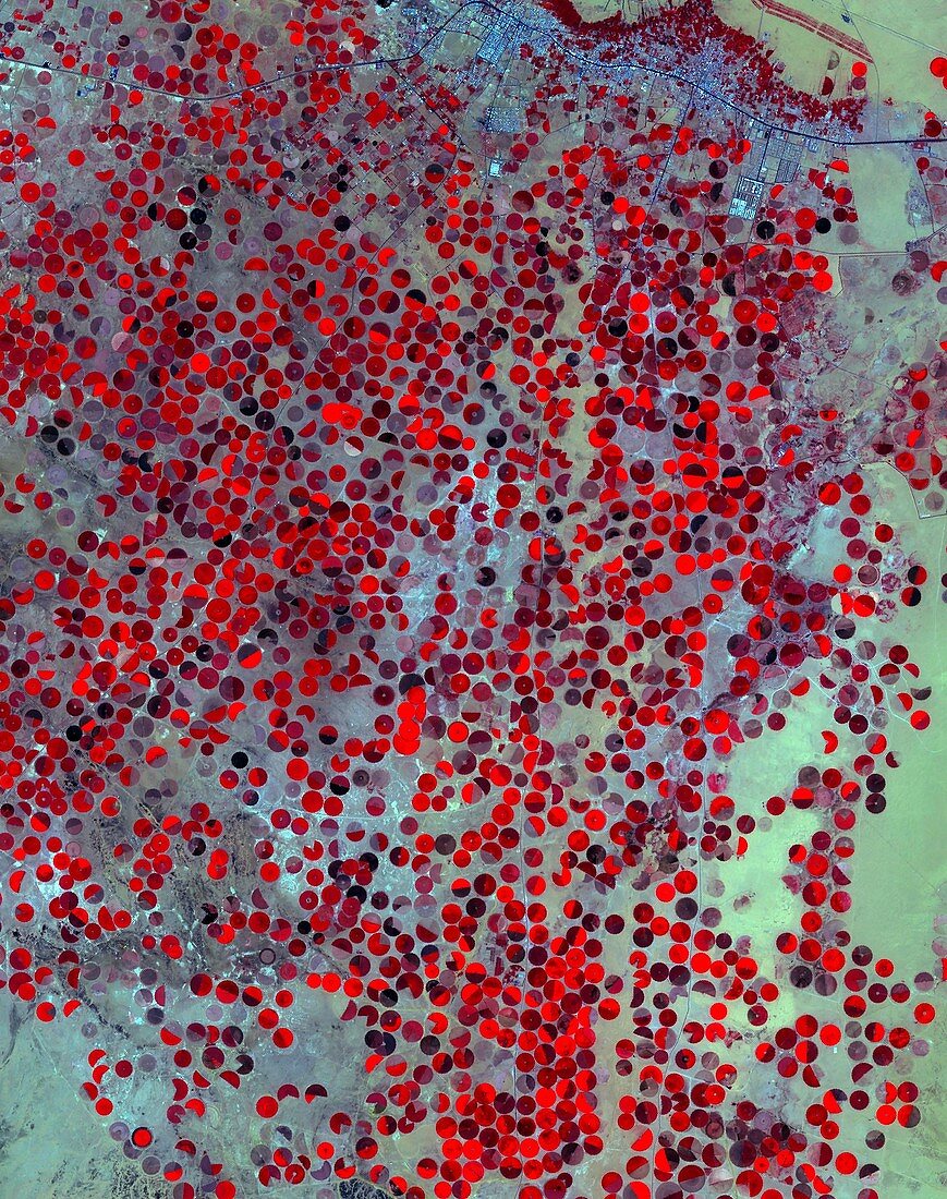
| Centre-pivot irrigation in Saudi Arabia, infrared satellite image. The circular fields here are irrigated by water brought to the desert surface from the Wajid Aquifer in Saudi Arabia and Yemen. This area is near Wadi Al Dawasir, Saudi Arabia. Heavy use of water has reduced the level in the aquifer system by 6 metres a year for the past 20 to 30 years, with exhaustion of the aquifer in some areas. This image covers an area of 34 by 44 kilometres. It was acquired on 26 April 2017 by the ASTER (Advanced Spaceborne Thermal Emission and Reflection Radiometer) sensor on the Terra satellite. | |
| Lizenzart: | Lizenzpflichtig |
| Credit: | Science Photo Library / US-Japan ASTER Science Team / Japan Space Systems / AIST / METI / NASA |
| Bildgröße: | 2902 px × 3674 px |
| Modell-Rechte: | nicht erforderlich |
| Eigentums-Rechte: | nicht erforderlich |
| Restrictions: | - |
Preise für dieses Bild ab 15 €
Universitäten & Organisationen
(Informationsmaterial Digital, Informationsmaterial Print, Lehrmaterial Digital etc.)
ab 15 €
Redaktionell
(Bücher, Bücher: Sach- und Fachliteratur, Digitale Medien (redaktionell) etc.)
ab 30 €
Werbung
(Anzeigen, Aussenwerbung, Digitale Medien, Fernsehwerbung, Karten, Werbemittel, Zeitschriften etc.)
ab 55 €
Handelsprodukte
(bedruckte Textilie, Kalender, Postkarte, Grußkarte, Verpackung etc.)
ab 75 €
Pauschalpreise
Rechtepakete für die unbeschränkte Bildnutzung in Print oder Online
ab 495 €