Urban sprawl in Texas, USA, infrared satellite images
Bildnummer 12991478
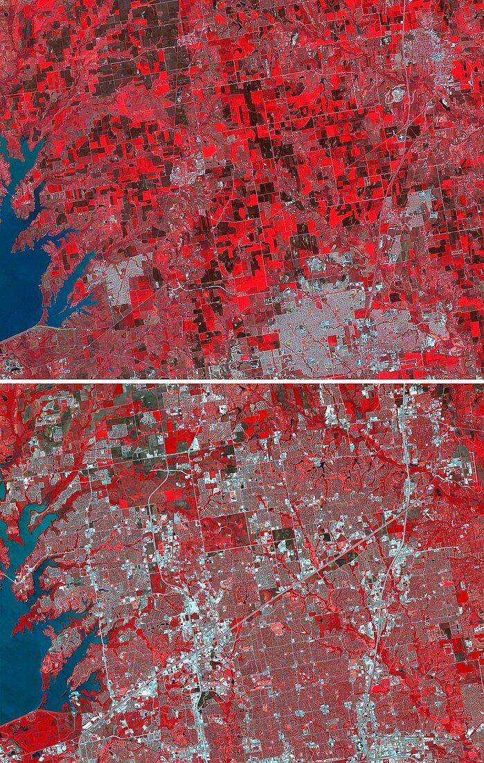
| Urban sprawl in Texas, USA. Infrared satellite images of the city (grey areas) of Frisco in Texas, USA, as it grew between 1984 (top) and 2018 (bottom). The city saw explosive growth between 9 April 1984 when the Thematic Mapper (TM) image was acquired, and 15 April 2018 when the ASTER (Advanced Spaceborne Thermal Emission and Reflection Radiometer) image was acquired. The city's population grew from 4, 500 to 174, 000. The images cover an area of 27 by 34.5 kilometres. The TM sensor was carried on the Landsat satellites, while the ASTER sensor is on the Terra satellite. | |
| Lizenzart: | Lizenzpflichtig |
| Credit: | Science Photo Library / US-Japan ASTER Science Team / Japan Space Systems / AIST / METI / NASA |
| Bildgröße: | 2585 px × 4068 px |
| Modell-Rechte: | nicht erforderlich |
| Eigentums-Rechte: | nicht erforderlich |
| Restrictions: | - |
Preise für dieses Bild ab 15 €
Universitäten & Organisationen
(Informationsmaterial Digital, Informationsmaterial Print, Lehrmaterial Digital etc.)
ab 15 €
Redaktionell
(Bücher, Bücher: Sach- und Fachliteratur, Digitale Medien (redaktionell) etc.)
ab 30 €
Werbung
(Anzeigen, Aussenwerbung, Digitale Medien, Fernsehwerbung, Karten, Werbemittel, Zeitschriften etc.)
ab 55 €
Handelsprodukte
(bedruckte Textilie, Kalender, Postkarte, Grußkarte, Verpackung etc.)
ab 75 €
Pauschalpreise
Rechtepakete für die unbeschränkte Bildnutzung in Print oder Online
ab 495 €