River Thames virtual reality pilot training simulator
Bildnummer 12986932
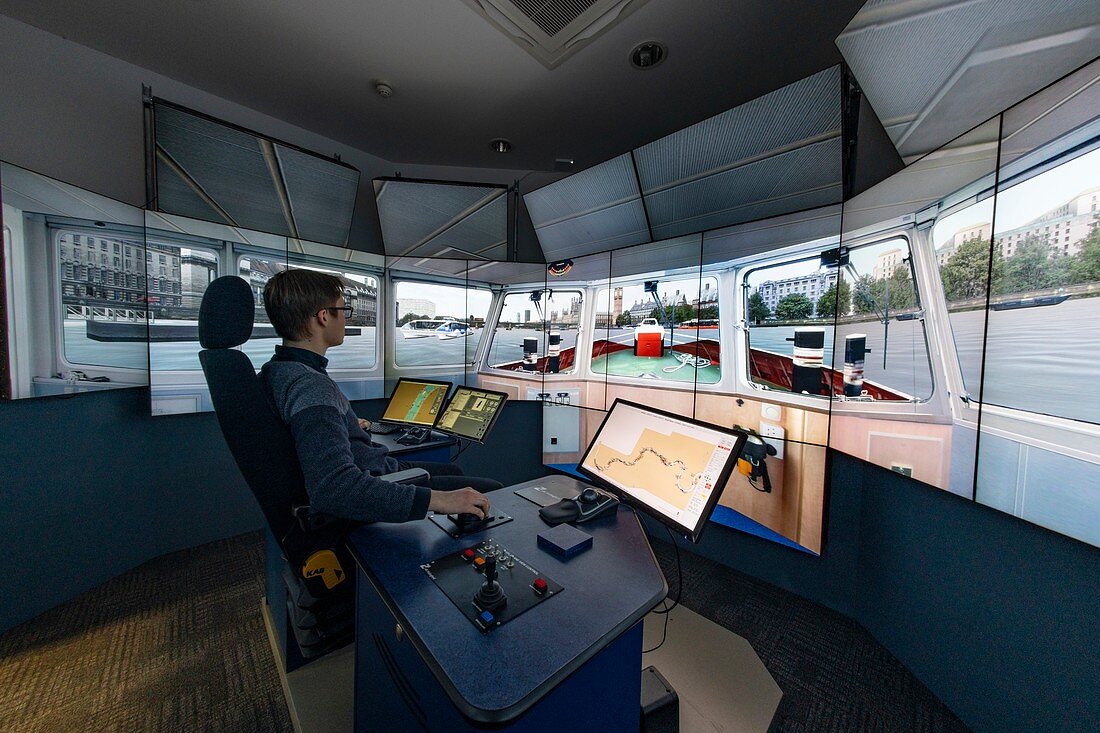
| Photo-real virtual reality simulation of the river Thames, London, UK, from Putney Bridge in the west, to Margaretness in the east. It incorporates tides, flows, other river traffic and changeable weather conditions. An underlying hydrodynamic model uses data from tide gauges and flow measurements along the Thames to simulate realistic flow and tide conditions on the river, and the company's naval architects have developed a suite of realistic ship manoeuvring models for the vessels used in the simulation. The simulation is used for training Tug master pilots. | |
| Lizenzart: | Lizenzpflichtig |
| Credit: | Science Photo Library / Murray, Louise |
| Bildgröße: | 8256 px × 5504 px |
| Modell-Rechte: | Derzeit liegt noch kein Release vor. Bitte kontaktieren Sie uns vor Verwendung. |
| Eigentums-Rechte: | nicht erforderlich |
| Restrictions: |
|
Preise für dieses Bild ab 15 €
Universitäten & Organisationen
(Informationsmaterial Digital, Informationsmaterial Print, Lehrmaterial Digital etc.)
ab 15 €
Redaktionell
(Bücher, Bücher: Sach- und Fachliteratur, Digitale Medien (redaktionell) etc.)
ab 30 €
Werbung
(Anzeigen, Aussenwerbung, Digitale Medien, Fernsehwerbung, Karten, Werbemittel, Zeitschriften etc.)
ab 55 €
Handelsprodukte
(bedruckte Textilie, Kalender, Postkarte, Grußkarte, Verpackung etc.)
ab 75 €
Pauschalpreise
Rechtepakete für die unbeschränkte Bildnutzung in Print oder Online
ab 495 €