Topography of Mercury, MESSENGER image
Bildnummer 12971723
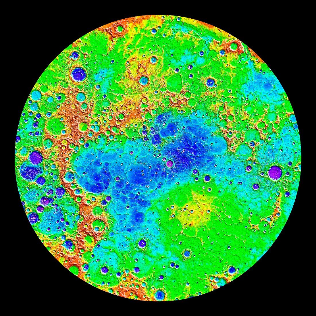
| Topography of Mercury, MESSENGER image. During its four-year mission, the MESSENGER (Mercury Surface, Space Environment, Geochemistry, and Ranging) spacecraft mapped the topography of Mercury's northern hemisphere. This relief map shows the lowest regions in purple, and the highest regions in red, with a maximum difference in elevation of around 10 kilometres. Among the prominent features visible here are the smooth northern volcanic plains. The low-lying craters near the north pole contain radar-bright materials, thought to be water ice. Image published in 2015. | |
| Lizenzart: | Lizenzpflichtig |
| Credit: | Science Photo Library / Carnegie Institution of Washington / Johns Hopkins University Applied Physics Laboratory / NASA |
| Bildgröße: | 4181 px × 4181 px |
| Modell-Rechte: | nicht erforderlich |
| Eigentums-Rechte: | nicht erforderlich |
| Restrictions: | - |
Preise für dieses Bild ab 15 €
Universitäten & Organisationen
(Informationsmaterial Digital, Informationsmaterial Print, Lehrmaterial Digital etc.)
ab 15 €
Redaktionell
(Bücher, Bücher: Sach- und Fachliteratur, Digitale Medien (redaktionell) etc.)
ab 30 €
Werbung
(Anzeigen, Aussenwerbung, Digitale Medien, Fernsehwerbung, Karten, Werbemittel, Zeitschriften etc.)
ab 55 €
Handelsprodukte
(bedruckte Textilie, Kalender, Postkarte, Grußkarte, Verpackung etc.)
ab 75 €
Pauschalpreise
Rechtepakete für die unbeschränkte Bildnutzung in Print oder Online
ab 495 €
Keywords
- 2015,
- Astronomie,
- astronomisch,
- Astrophysik,
- astrophysikalisch,
- ausgeschnitten,
- Ausschnitte,
- Ball,
- Globus,
- Karte,
- Kreis,
- kreisförmig,
- Kugel,
- kugelförmig,
- Merkur,
- Niemand,
- nördliche Hemisphäre,
- Nordpol,
- Planet,
- Planetenwissenschaft,
- polar,
- Raum,
- Satellitenbild,
- schwarzer Hintergrund,
- Sonnensystem,
- topografisch,
- Topographie,
- Weltall