Antenna deployment for Shuttle Radar Topographic Mission
Bildnummer 12961782
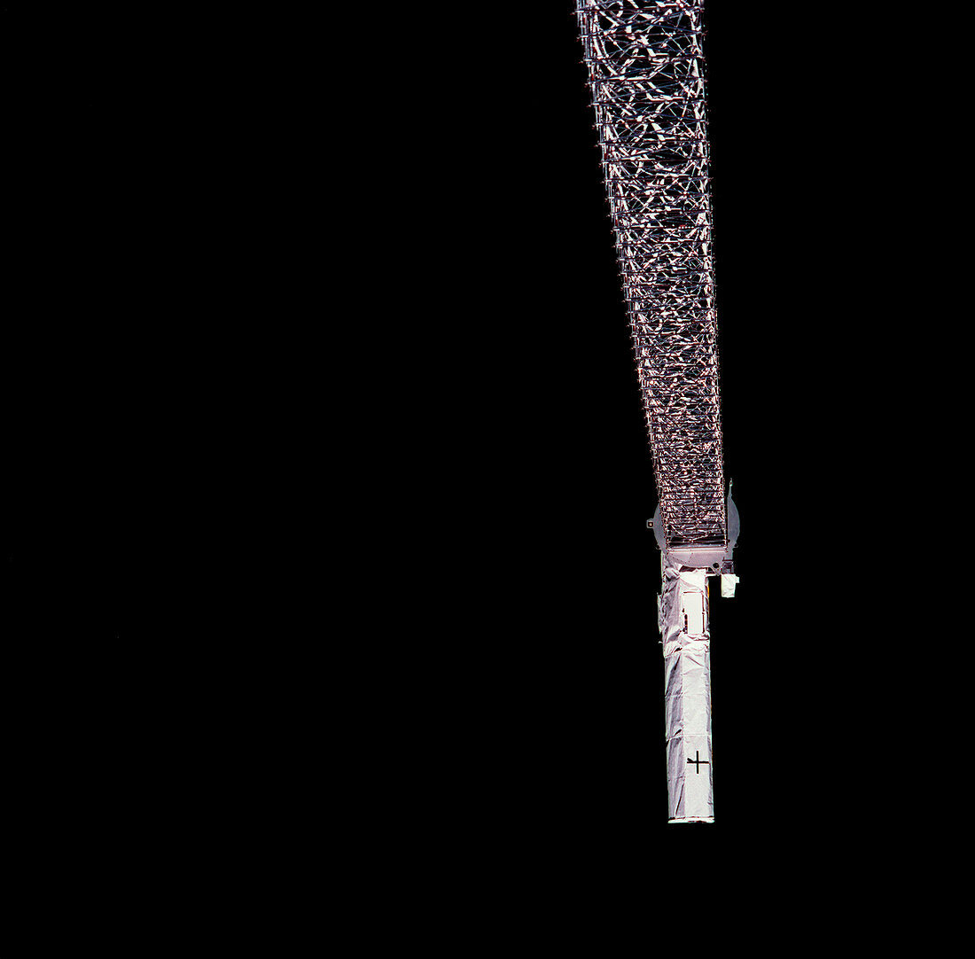
| Antenna deployment for Shuttle Radar Topographic Mission. Launched on 11 February 2000,the STS-99 Shuttle Radar Topographic Mission (SRTM) was the most ambitious Earth mapping mission of its time. The Space Shuttle Endeavour orbited some 233 kilometres above the Earth. It used C-band and X-band outboard antennae,one located in the Shuttle bay and one on the end of this 60-metre deployable mast. The SRTM radar was able to penetrate clouds as well as provide its own illumination,independent of daylight,obtaining 3-dimensional topographic images of the world's surface up to the Arctic and Antarctic Circles. The mission completed 222 hours of continuous radar mapping. Photographed in February 2000. | |
| Lizenzart: | Lizenzpflichtig |
| Credit: | Science Photo Library / NASA |
| Bildgröße: | 3000 px × 2952 px |
| Modell-Rechte: | nicht erforderlich |
| Eigentums-Rechte: | nicht erforderlich |
| Restrictions: | - |
Preise für dieses Bild ab 15 €
Universitäten & Organisationen
(Informationsmaterial Digital, Informationsmaterial Print, Lehrmaterial Digital etc.)
ab 15 €
Redaktionell
(Bücher, Bücher: Sach- und Fachliteratur, Digitale Medien (redaktionell) etc.)
ab 30 €
Werbung
(Anzeigen, Aussenwerbung, Digitale Medien, Fernsehwerbung, Karten, Werbemittel, Zeitschriften etc.)
ab 55 €
Handelsprodukte
(bedruckte Textilie, Kalender, Postkarte, Grußkarte, Verpackung etc.)
ab 75 €
Pauschalpreise
Rechtepakete für die unbeschränkte Bildnutzung in Print oder Online
ab 495 €