World map,16th century
Bildnummer 12959998
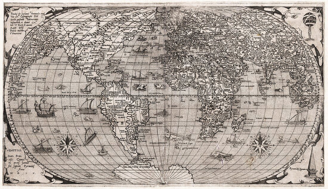
| World map,16th century. This 1560 world map by Paolo Forlani and Giacomo Gastaldi is from 'Geografia tavole moderne di geografia' (1575) by Antonio Lafreri. It includes the first appearance of the name 'Canada' on a printed map. Also featured in the oceans are a number of compass roses,ships and sea monsters. Japan is not yet shown,and nor is Australia. The top right and bottom right corners of the map feature an armillary sphere and a symbolic pyramidal object. | |
| Lizenzart: | Lizenzpflichtig |
| Credit: | Science Photo Library / Library of Congress,Geography and Map Division |
| Bildgröße: | 5471 px × 3146 px |
| Modell-Rechte: | nicht erforderlich |
| Eigentums-Rechte: | nicht erforderlich |
| Restrictions: | - |
Preise für dieses Bild ab 15 €
Universitäten & Organisationen
(Informationsmaterial Digital, Informationsmaterial Print, Lehrmaterial Digital etc.)
ab 15 €
Redaktionell
(Bücher, Bücher: Sach- und Fachliteratur, Digitale Medien (redaktionell) etc.)
ab 30 €
Werbung
(Anzeigen, Aussenwerbung, Digitale Medien, Fernsehwerbung, Karten, Werbemittel, Zeitschriften etc.)
ab 55 €
Handelsprodukte
(bedruckte Textilie, Kalender, Postkarte, Grußkarte, Verpackung etc.)
ab 75 €
Pauschalpreise
Rechtepakete für die unbeschränkte Bildnutzung in Print oder Online
ab 495 €
Keywords
- 1500er Jahre,
- 16. Jahrhundert,
- Afrika,
- Afrikanisch,
- Armillarsphäre,
- Asiatisch,
- Asien,
- Einfarbig,
- Erde,
- Europa,
- europäisch,
- gedruckter Text,
- geografisch,
- Geographie,
- Geschichte,
- historisch,
- Kanada,
- Karte,
- Kartographie,
- Kontinent,
- Kontinente,
- Niemand,
- Nordamerika,
- nordamerikanisch,
- Pyramide,
- Schiffe,
- Schwarz und weiß,
- Südamerika,
- Südamerikanisch,
- Weltkarte