Northern Serbia, satellite image
Bildnummer 12950704
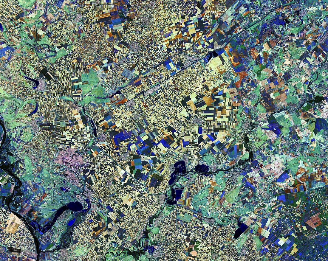
| Northern Serbia, satellite image. The colours (representing 13 spectral bands) indicate the state of the vegetation. Yellowish patches indicate soil or freshly ploughed land, while shades of blue (primarily at lower left) indicate either the same crop or different crops at a similar stage of growth. This information can be used to improve farming outputs and to manage environmental impacts. Image data obtained on 28 August 2016, by the Copernicus Sentinel-2 satellites. | |
| Lizenzart: | Lizenzpflichtig |
| Credit: | Science Photo Library / Copernicus Sentinel data (2016) / EUROPEAN SPACE AGENCY |
| Bildgröße: | 3356 px × 2673 px |
| Modell-Rechte: | nicht erforderlich |
| Eigentums-Rechte: | nicht erforderlich |
| Restrictions: |
|
Preise für dieses Bild ab 15 €
Universitäten & Organisationen
(Informationsmaterial Digital, Informationsmaterial Print, Lehrmaterial Digital etc.)
ab 15 €
Redaktionell
(Bücher, Bücher: Sach- und Fachliteratur, Digitale Medien (redaktionell) etc.)
ab 30 €
Werbung
(Anzeigen, Aussenwerbung, Digitale Medien, Fernsehwerbung, Karten, Werbemittel, Zeitschriften etc.)
ab 55 €
Handelsprodukte
(bedruckte Textilie, Kalender, Postkarte, Grußkarte, Verpackung etc.)
ab 75 €
Pauschalpreise
Rechtepakete für die unbeschränkte Bildnutzung in Print oder Online
ab 495 €