Iceland, LiDAR image
Bildnummer 12950693
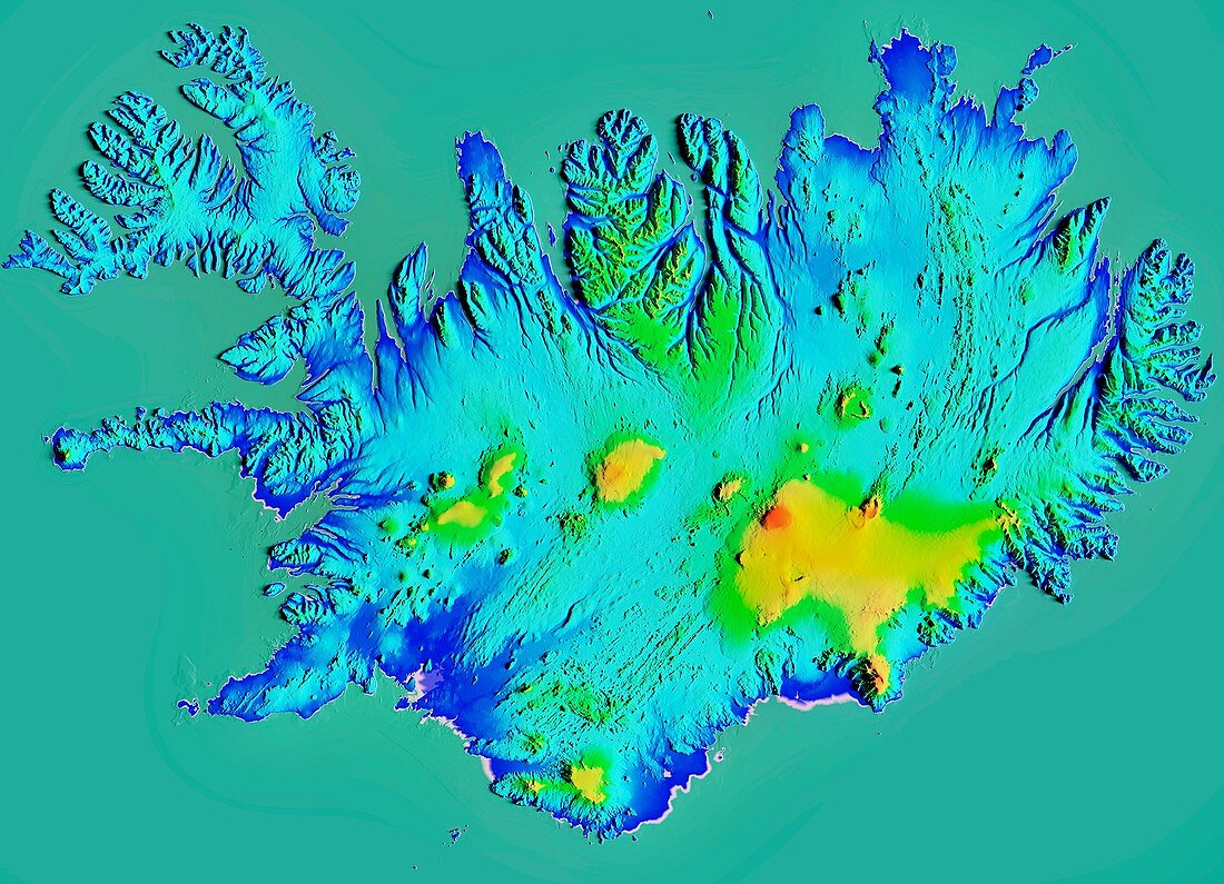
| Iceland, LiDAR image. North is at top. Iceland is an island country in the North Atlantic, that is geologically part of the Mid-Atlantic Ridge. It is volcanically active, and in addition to its volcanoes it has glaciers and many fjords along its long coastline. The highest elevation (red, centre right) is 2110 metres at the summit of the Oraefajokull volcano in Vatnajokull National Park. LiDAR combines optical and laser imaging to produce digital elevation maps (DEMs), with differences in elevation shown by the colour-coding of the image. Image data from the National Land Survey of Iceland (NLSI). | |
| Lizenzart: | Lizenzpflichtig |
| Credit: | Science Photo Library / Hurst, Matthew |
| Bildgröße: | 4919 px × 3553 px |
| Modell-Rechte: | nicht erforderlich |
| Eigentums-Rechte: | nicht erforderlich |
| Restrictions: | - |
Preise für dieses Bild ab 15 €
Universitäten & Organisationen
(Informationsmaterial Digital, Informationsmaterial Print, Lehrmaterial Digital etc.)
ab 15 €
Redaktionell
(Bücher, Bücher: Sach- und Fachliteratur, Digitale Medien (redaktionell) etc.)
ab 30 €
Werbung
(Anzeigen, Aussenwerbung, Digitale Medien, Fernsehwerbung, Karten, Werbemittel, Zeitschriften etc.)
ab 55 €
Handelsprodukte
(bedruckte Textilie, Kalender, Postkarte, Grußkarte, Verpackung etc.)
ab 75 €
Pauschalpreise
Rechtepakete für die unbeschränkte Bildnutzung in Print oder Online
ab 495 €