Sand dunes in the Namib Desert, LiDAR satellite image
Bildnummer 12950691
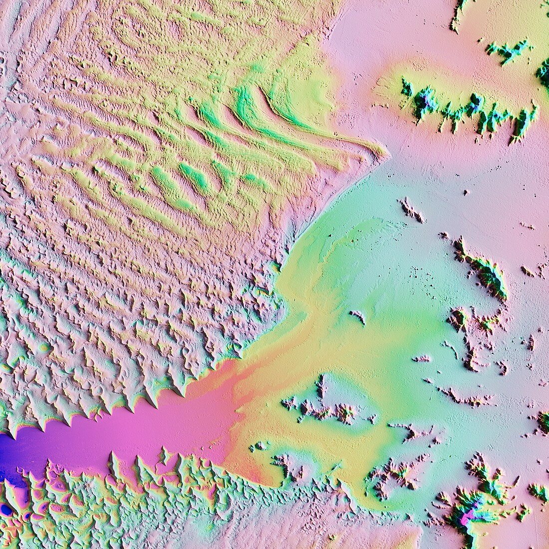
| Sand dunes in the Namib Desert, LiDAR satellite image. The desert sands here are piled up high by coastal winds (from left) to form the world's tallest sand dunes (ripples). The dunes can reach 300 metres in height. This is a region of the Namib Desert in Namibia designated the Namib-Naukluft National Park. The Sossusvlei clay pan (lower centre) was eroded and deposited by rare heavy rains that run off the high ground to the right. LiDAR combines optical and laser imaging to produce digital elevation maps (DEMs), with differences in elevation shown by the colour-coding of the image. Image data obtained by the radar and optical sensors on the Advanced Land Observation Satellite (ALOS) of the Japan Aerospace Exploration Agency (JAXA). | |
| Lizenzart: | Lizenzpflichtig |
| Credit: | Science Photo Library / JAXA / MATTHEW HURST |
| Bildgröße: | 4180 px × 4180 px |
| Modell-Rechte: | nicht erforderlich |
| Eigentums-Rechte: | nicht erforderlich |
| Restrictions: | - |
Preise für dieses Bild ab 15 €
Universitäten & Organisationen
(Informationsmaterial Digital, Informationsmaterial Print, Lehrmaterial Digital etc.)
ab 15 €
Redaktionell
(Bücher, Bücher: Sach- und Fachliteratur, Digitale Medien (redaktionell) etc.)
ab 30 €
Werbung
(Anzeigen, Aussenwerbung, Digitale Medien, Fernsehwerbung, Karten, Werbemittel, Zeitschriften etc.)
ab 55 €
Handelsprodukte
(bedruckte Textilie, Kalender, Postkarte, Grußkarte, Verpackung etc.)
ab 75 €
Pauschalpreise
Rechtepakete für die unbeschränkte Bildnutzung in Print oder Online
ab 495 €