Grand Canyon, LiDAR satellite image
Bildnummer 12950686
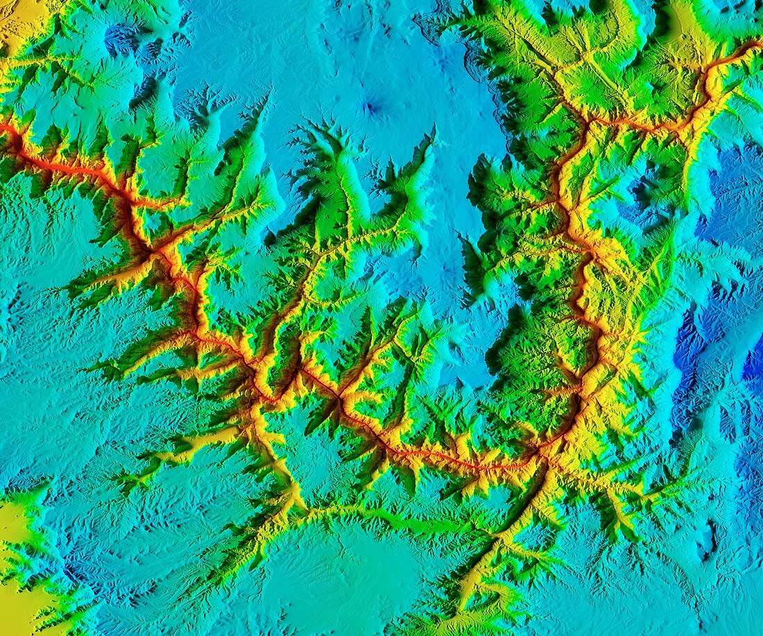
| Grand Canyon, LiDAR satellite image. Located in Arizona, USA, the 6-million-year-old Grand Canyon system is a set of gorges eroded from the rock by the Colorado River. It extends for hundreds of kilometres, is nearly 30 kilometres wide, and at its deepest is 1.5 kilometres deep. LiDAR combines optical and laser imaging to produce digital elevation maps (DEMs), with differences in elevation shown by the colour-coding of the image. Image data obtained by the radar and optical sensors on the Advanced Land Observation Satellite (ALOS) of the Japan Aerospace Exploration Agency (JAXA). | |
| Lizenzart: | Lizenzpflichtig |
| Credit: | Science Photo Library / JAXA / MATTHEW HURST |
| Bildgröße: | 4579 px × 3816 px |
| Modell-Rechte: | nicht erforderlich |
| Eigentums-Rechte: | nicht erforderlich |
| Restrictions: | - |
Preise für dieses Bild ab 15 €
Universitäten & Organisationen
(Informationsmaterial Digital, Informationsmaterial Print, Lehrmaterial Digital etc.)
ab 15 €
Redaktionell
(Bücher, Bücher: Sach- und Fachliteratur, Digitale Medien (redaktionell) etc.)
ab 30 €
Werbung
(Anzeigen, Aussenwerbung, Digitale Medien, Fernsehwerbung, Karten, Werbemittel, Zeitschriften etc.)
ab 55 €
Handelsprodukte
(bedruckte Textilie, Kalender, Postkarte, Grußkarte, Verpackung etc.)
ab 75 €
Pauschalpreise
Rechtepakete für die unbeschränkte Bildnutzung in Print oder Online
ab 495 €