Smoke from Indonesian fires, satellite image
Bildnummer 12949161
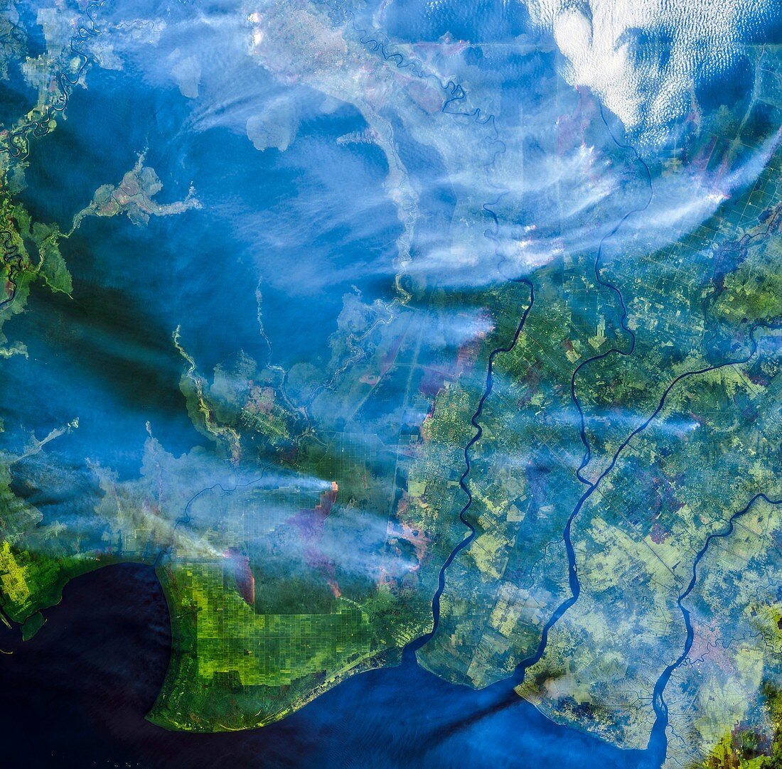
| Smoke from Indonesian fires, satellite image. Smoke from fires burning in oil palm areas in southern Borneo (Kalimantan) in Indonesia. The fires are typically started by farmers burning off agricultural and logging debris to clear the way for new crops such as oil palm and acacia pulp. Shortwave-infrared observations have been placed over a natural-color image to highlight the locations of active fires (one at lower centre, orange). This image was obtained in September 2019 by the Operational Land Imager (OLI) on Landsat 8. | |
| Lizenzart: | Lizenzpflichtig |
| Credit: | Science Photo Library / NASA / US Geological Survey Earth Observatory |
| Bildgröße: | 4619 px × 4544 px |
| Modell-Rechte: | nicht erforderlich |
| Eigentums-Rechte: | nicht erforderlich |
| Restrictions: | - |
Preise für dieses Bild ab 15 €
Universitäten & Organisationen
(Informationsmaterial Digital, Informationsmaterial Print, Lehrmaterial Digital etc.)
ab 15 €
Redaktionell
(Bücher, Bücher: Sach- und Fachliteratur, Digitale Medien (redaktionell) etc.)
ab 30 €
Werbung
(Anzeigen, Aussenwerbung, Digitale Medien, Fernsehwerbung, Karten, Werbemittel, Zeitschriften etc.)
ab 55 €
Handelsprodukte
(bedruckte Textilie, Kalender, Postkarte, Grußkarte, Verpackung etc.)
ab 75 €
Pauschalpreise
Rechtepakete für die unbeschränkte Bildnutzung in Print oder Online
ab 495 €