Hurricane Dorian over the Bahamas, satellite image
Bildnummer 12920058
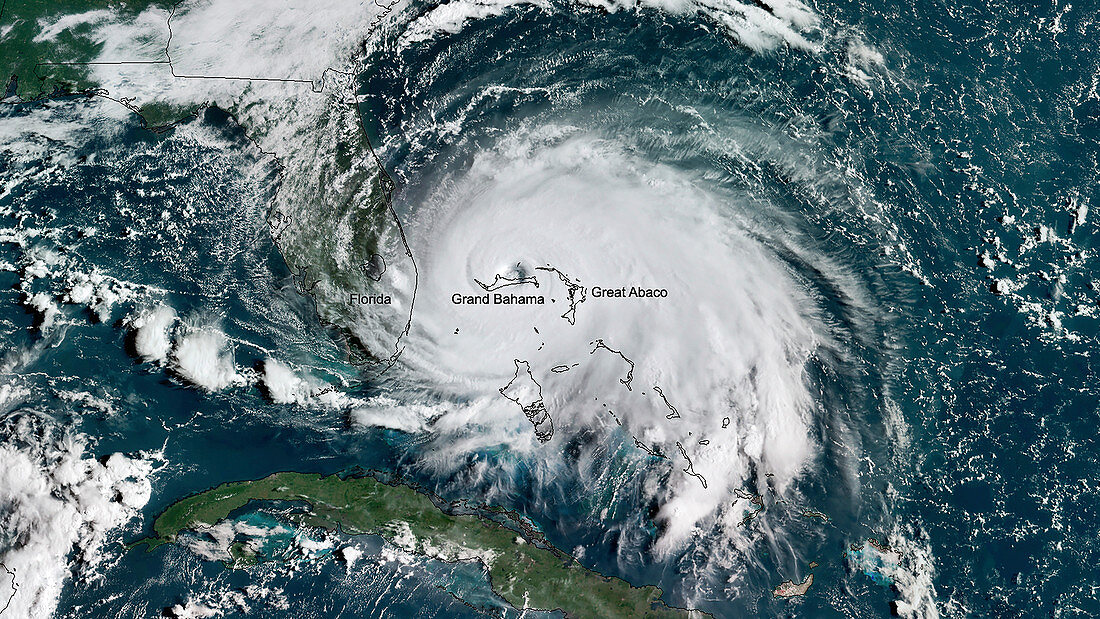
| Hurricane Dorian over the Bahamas, satellite image. Hurricane Dorian reached category 5 strength on 1 September 2019, making landfall in the Bahamas where it caused extensive damage and flooding due to high winds, prolonged rainfall and storm surges, especially on islands and associated islands of Great Abaco and Grand Bahama (labelled). This image was obtained by the GOES East (GOES-16) satellite on 2 September 2019. | |
| Lizenzart: | Lizenzpflichtig |
| Credit: | Science Photo Library / Environmental Visualization Laboratory / NOAA |
| Bildgröße: | 3988 px × 2244 px |
| Modell-Rechte: | nicht erforderlich |
| Eigentums-Rechte: | nicht erforderlich |
| Restrictions: |
|
Preise für dieses Bild ab 15 €
Universitäten & Organisationen
(Informationsmaterial Digital, Informationsmaterial Print, Lehrmaterial Digital etc.)
ab 15 €
Redaktionell
(Bücher, Bücher: Sach- und Fachliteratur, Digitale Medien (redaktionell) etc.)
ab 30 €
Werbung
(Anzeigen, Aussenwerbung, Digitale Medien, Fernsehwerbung, Karten, Werbemittel, Zeitschriften etc.)
ab 55 €
Handelsprodukte
(bedruckte Textilie, Kalender, Postkarte, Grußkarte, Verpackung etc.)
ab 75 €
Pauschalpreise
Rechtepakete für die unbeschränkte Bildnutzung in Print oder Online
ab 495 €