ADM-Aeolus satellite orbit, illustration
Bildnummer 12644196
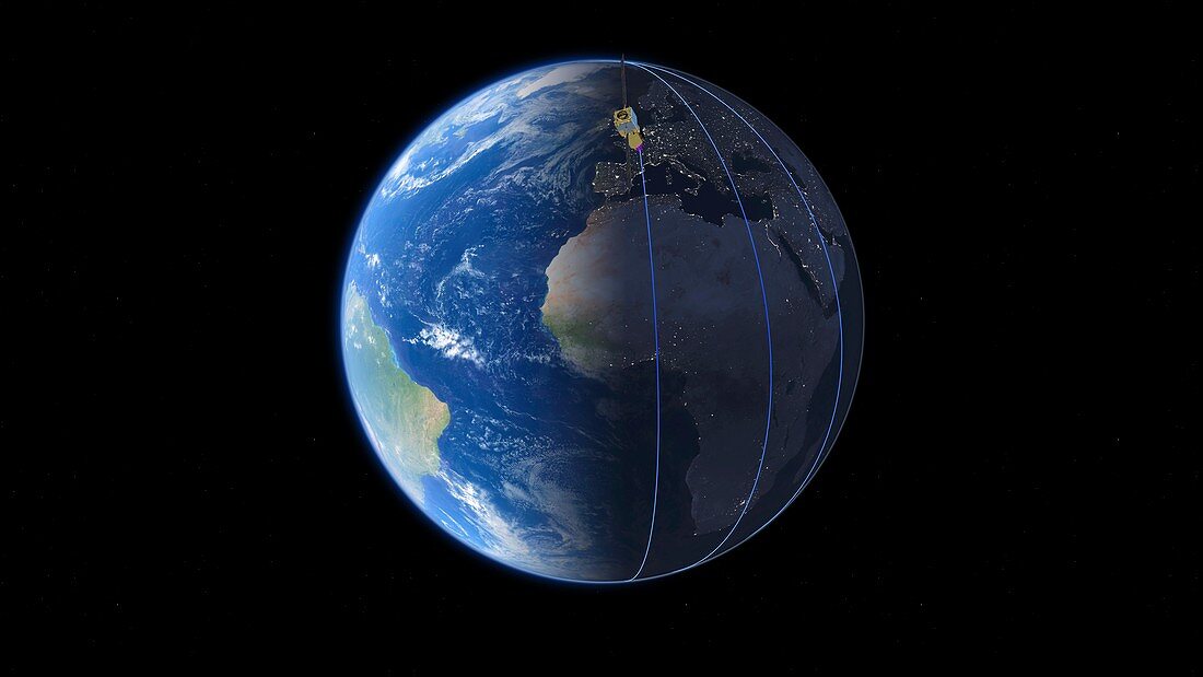
| Illustration showing the polar orbit of the European Space Agency's (ESA) wind mission satellite ADM-Aeolus (Atmospheric Dynamics Mission Aeolus). This satellite, launched on 22 August 2018, is intended to provide data on winds, aerosols (atmospheric particles) and clouds. It will orbit Earth at an altitude of 320 kilometres, taking 90 minutes to complete one orbit, and seven days to cover the globe. It has a single instrument, a Doppler wind lidar (laser-based sensor) called ALADIN. It will probe the lowermost 30 kilometres of the atmosphere, and will be the first wind lidar in space. Data will be used to help improve weather forecasts, such as the prediction of mid-latitude cyclone systems. | |
| Lizenzart: | Lizenzpflichtig |
| Credit: | Science Photo Library / ESA / ATG Medialab |
| Bildgröße: | 7291 px × 4103 px |
| Modell-Rechte: | nicht erforderlich |
| Eigentums-Rechte: | nicht erforderlich |
| Restrictions: |
|
Preise für dieses Bild ab 15 €
Universitäten & Organisationen
(Informationsmaterial Digital, Informationsmaterial Print, Lehrmaterial Digital etc.)
ab 15 €
Redaktionell
(Bücher, Bücher: Sach- und Fachliteratur, Digitale Medien (redaktionell) etc.)
ab 30 €
Werbung
(Anzeigen, Aussenwerbung, Digitale Medien, Fernsehwerbung, Karten, Werbemittel, Zeitschriften etc.)
ab 55 €
Handelsprodukte
(bedruckte Textilie, Kalender, Postkarte, Grußkarte, Verpackung etc.)
ab 75 €
Pauschalpreise
Rechtepakete für die unbeschränkte Bildnutzung in Print oder Online
ab 495 €