Historical map of the Battle of Marathon
Bildnummer 12642748
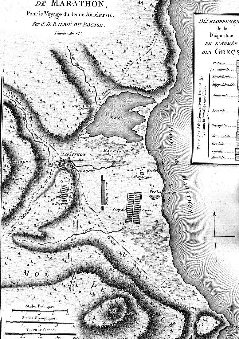
| Historical map of the Battle of Marathon. 18th-century illustration of a map from antiquity of the site of the Battle of Marathon (490 BC) between the Greeks and Persians, from the atlas by French cartographer Jean-Denis Barbie du Bocage (1760-1825) to accompany 'The Travels of Anacharsis the Younger in Greece' (1787) by French writer Jean-Jacques Barthelemy (1716-1795). This work, which the author pretend was by a grandson of a 6th-century-BC Scythian philosopher, was intended to popularise classical Greek history. Map engraved in the 1780s. | |
| Lizenzart: | Lizenzpflichtig |
| Credit: | Science Photo Library / Collection Abecasis |
| Bildgröße: | 2605 px × 3685 px |
| Modell-Rechte: | nicht erforderlich |
| Eigentums-Rechte: | nicht erforderlich |
| Restrictions: | - |
Preise für dieses Bild ab 15 €
Universitäten & Organisationen
(Informationsmaterial Digital, Informationsmaterial Print, Lehrmaterial Digital etc.)
ab 15 €
Redaktionell
(Bücher, Bücher: Sach- und Fachliteratur, Digitale Medien (redaktionell) etc.)
ab 30 €
Werbung
(Anzeigen, Aussenwerbung, Digitale Medien, Fernsehwerbung, Karten, Werbemittel, Zeitschriften etc.)
ab 55 €
Handelsprodukte
(bedruckte Textilie, Kalender, Postkarte, Grußkarte, Verpackung etc.)
ab 75 €
Pauschalpreise
Rechtepakete für die unbeschränkte Bildnutzung in Print oder Online
ab 495 €