Deforestation in Paraguay, satellite image
Bildnummer 12582899
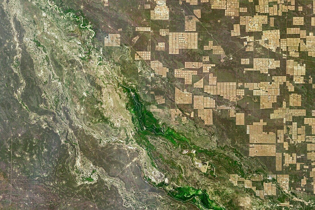
| Deforestation in Paraguay. Satellite image of areas of deforestation (light brown squares) in the Gran Chaco plain. This ecosystem is a dry forest of thorny trees, shrubs, and grasses covering parts of Paraguay, Argentina, and Bolivia. Around 20 percent (142, 000 square kilometres) has been converted into farmland or grazing since 1985. The area shown here is in Boqueron, just east of the Pilcomayo River near Tezen in Paraguay. Image data obtained by the Operational Land Imager (OLI) on Landsat 8 on 14 August 2016. | |
| Lizenzart: | Lizenzpflichtig |
| Credit: | Science Photo Library / NASA / US Geological Survey Earth Observatory |
| Bildgröße: | 5618 px × 3745 px |
| Modell-Rechte: | nicht erforderlich |
| Eigentums-Rechte: | nicht erforderlich |
| Restrictions: | - |
Preise für dieses Bild ab 15 €
Universitäten & Organisationen
(Informationsmaterial Digital, Informationsmaterial Print, Lehrmaterial Digital etc.)
ab 15 €
Redaktionell
(Bücher, Bücher: Sach- und Fachliteratur, Digitale Medien (redaktionell) etc.)
ab 30 €
Werbung
(Anzeigen, Aussenwerbung, Digitale Medien, Fernsehwerbung, Karten, Werbemittel, Zeitschriften etc.)
ab 55 €
Handelsprodukte
(bedruckte Textilie, Kalender, Postkarte, Grußkarte, Verpackung etc.)
ab 75 €
Pauschalpreise
Rechtepakete für die unbeschränkte Bildnutzung in Print oder Online
ab 495 €