Zaatari Refugee Camp, Jordan, satellite image
Bildnummer 12540278
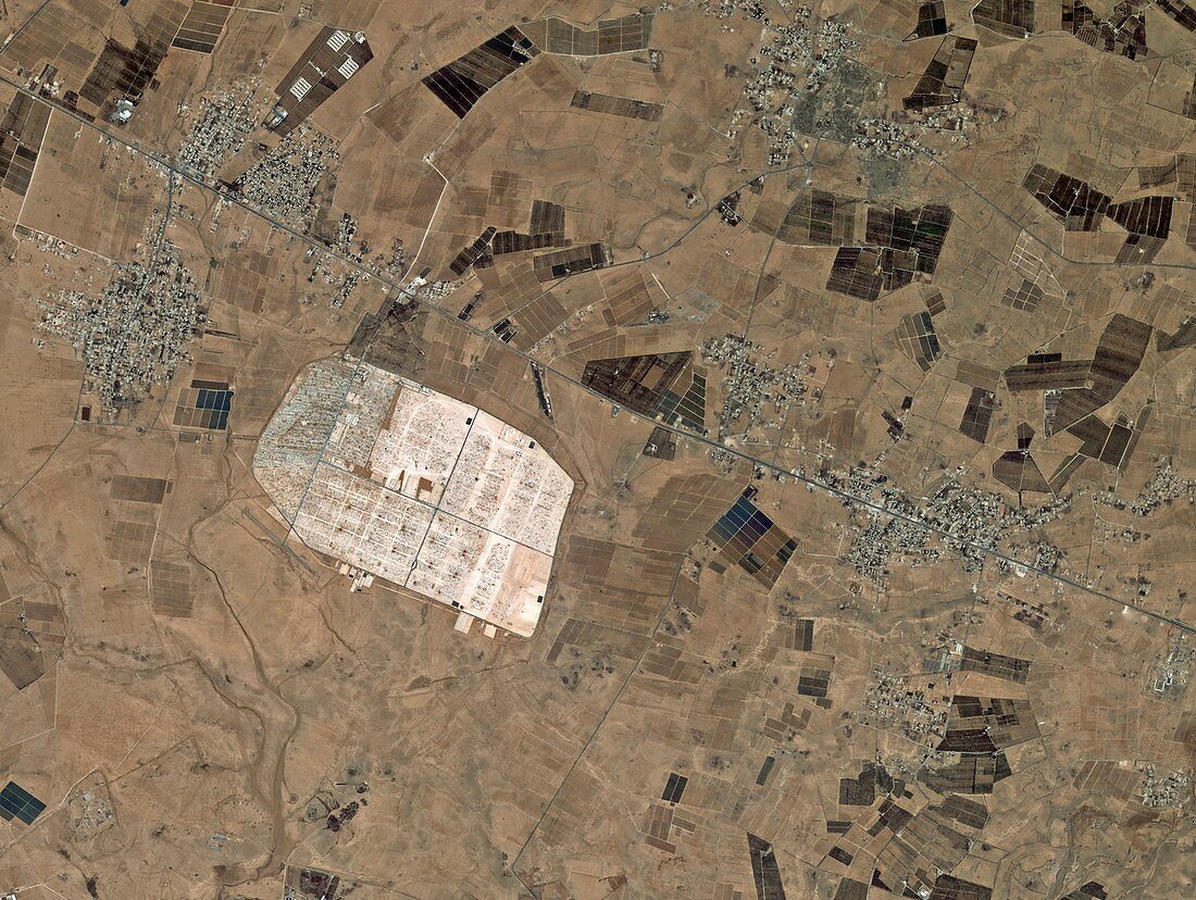
| Zaatari Refugee Camp, Jordan, satellite image. This image shows an area 13 kilometres east of the city of Mafraq in northern Jordan, between the Syrian Desert and volcanic Hauran plateau. Located just over 10 kilometres from the border with Syria, the camp was at this time home to over 100 000 people displaced by the conflict in the neighbouring country. Image acquired on 5 June 2013 by the Korean Kompsat-2 satellite. | |
| Lizenzart: | Lizenzpflichtig |
| Credit: | Science Photo Library / KARI / ESA |
| Bildgröße: | 2823 px × 2125 px |
| Modell-Rechte: | nicht erforderlich |
| Eigentums-Rechte: | nicht erforderlich |
| Restrictions: |
|
Preise für dieses Bild ab 15 €
Universitäten & Organisationen
(Informationsmaterial Digital, Informationsmaterial Print, Lehrmaterial Digital etc.)
ab 15 €
Redaktionell
(Bücher, Bücher: Sach- und Fachliteratur, Digitale Medien (redaktionell) etc.)
ab 30 €
Werbung
(Anzeigen, Aussenwerbung, Digitale Medien, Fernsehwerbung, Karten, Werbemittel, Zeitschriften etc.)
ab 55 €
Handelsprodukte
(bedruckte Textilie, Kalender, Postkarte, Grußkarte, Verpackung etc.)
ab 75 €
Pauschalpreise
Rechtepakete für die unbeschränkte Bildnutzung in Print oder Online
ab 495 €