Earthquake ground displacement, Italy, August 2016
Bildnummer 12540232
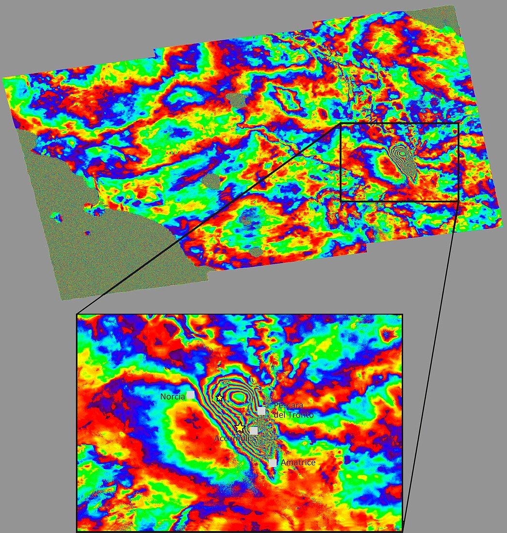
| Ground displacement due to earthquake, Italy. Satellite radar map of the region of central Italy struck by an earthquake on 24th August 2016. Italy's Institute for Electromagnetic Sensing of the Environment combined Sentinel-1 radar acquisitions over central Italy from before and after the earthquake: 15 August and 27 August 2016. The result is an interferogram' showing ground deformation caused by the 24 August earthquake. | |
| Lizenzart: | Lizenzpflichtig |
| Credit: | Science Photo Library / CNR-IREA / ESA |
| Bildgröße: | 4446 px × 4682 px |
| Modell-Rechte: | nicht erforderlich |
| Eigentums-Rechte: | nicht erforderlich |
| Restrictions: |
|
Preise für dieses Bild ab 15 €
Universitäten & Organisationen
(Informationsmaterial Digital, Informationsmaterial Print, Lehrmaterial Digital etc.)
ab 15 €
Redaktionell
(Bücher, Bücher: Sach- und Fachliteratur, Digitale Medien (redaktionell) etc.)
ab 30 €
Werbung
(Anzeigen, Aussenwerbung, Digitale Medien, Fernsehwerbung, Karten, Werbemittel, Zeitschriften etc.)
ab 55 €
Handelsprodukte
(bedruckte Textilie, Kalender, Postkarte, Grußkarte, Verpackung etc.)
ab 75 €
Pauschalpreise
Rechtepakete für die unbeschränkte Bildnutzung in Print oder Online
ab 495 €