Martian highlands and lowlands, Mars Express image
Bildnummer 12539688
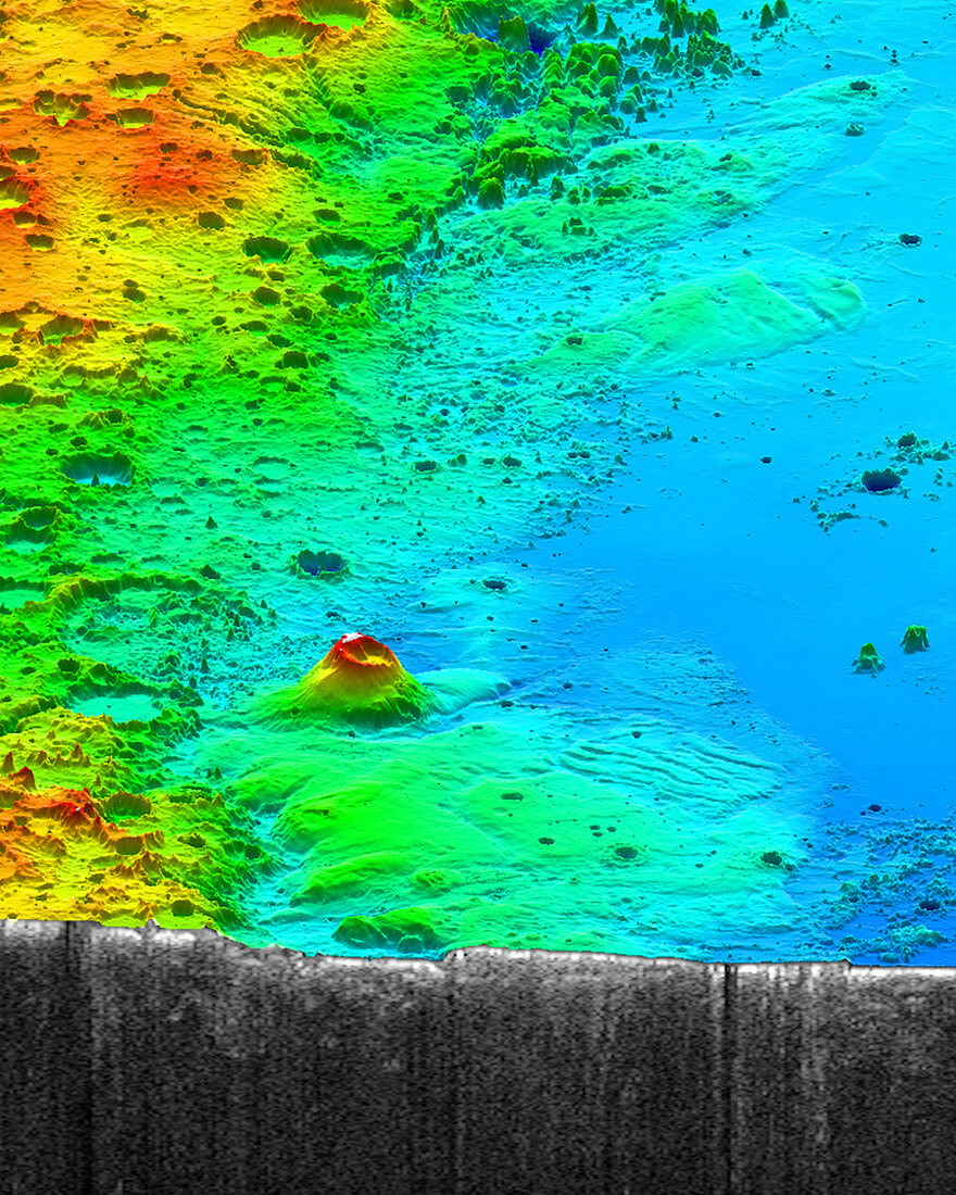
| Mars Express radar image of the topographic divide between the Martian highlands and lowlands. This area contains the Medusae Fossae Formation, a region of of soft, easily eroded deposit that extends for nearly 1000 kilometres along the Martian equator. Image obtained by the spacecraft's MARSIS (Mars Advanced Radar for Subsurface and Ionosphere Sounding) instrument. | |
| Lizenzart: | Lizenzpflichtig |
| Credit: | Science Photo Library / Smithsonian / JPL / Univ. of Rome / NASA / ASI / ESA |
| Bildgröße: | 1200 px × 1500 px |
| Modell-Rechte: | nicht erforderlich |
| Eigentums-Rechte: | nicht erforderlich |
| Restrictions: |
|
Preise für dieses Bild ab 15 €
Universitäten & Organisationen
(Informationsmaterial Digital, Informationsmaterial Print, Lehrmaterial Digital etc.)
ab 15 €
Redaktionell
(Bücher, Bücher: Sach- und Fachliteratur, Digitale Medien (redaktionell) etc.)
ab 30 €
Werbung
(Anzeigen, Aussenwerbung, Digitale Medien, Fernsehwerbung, Karten, Werbemittel, Zeitschriften etc.)
ab 55 €
Handelsprodukte
(bedruckte Textilie, Kalender, Postkarte, Grußkarte, Verpackung etc.)
ab 75 €
Pauschalpreise
Rechtepakete für die unbeschränkte Bildnutzung in Print oder Online
ab 495 €