British Isles, 17th century
Bildnummer 12450107
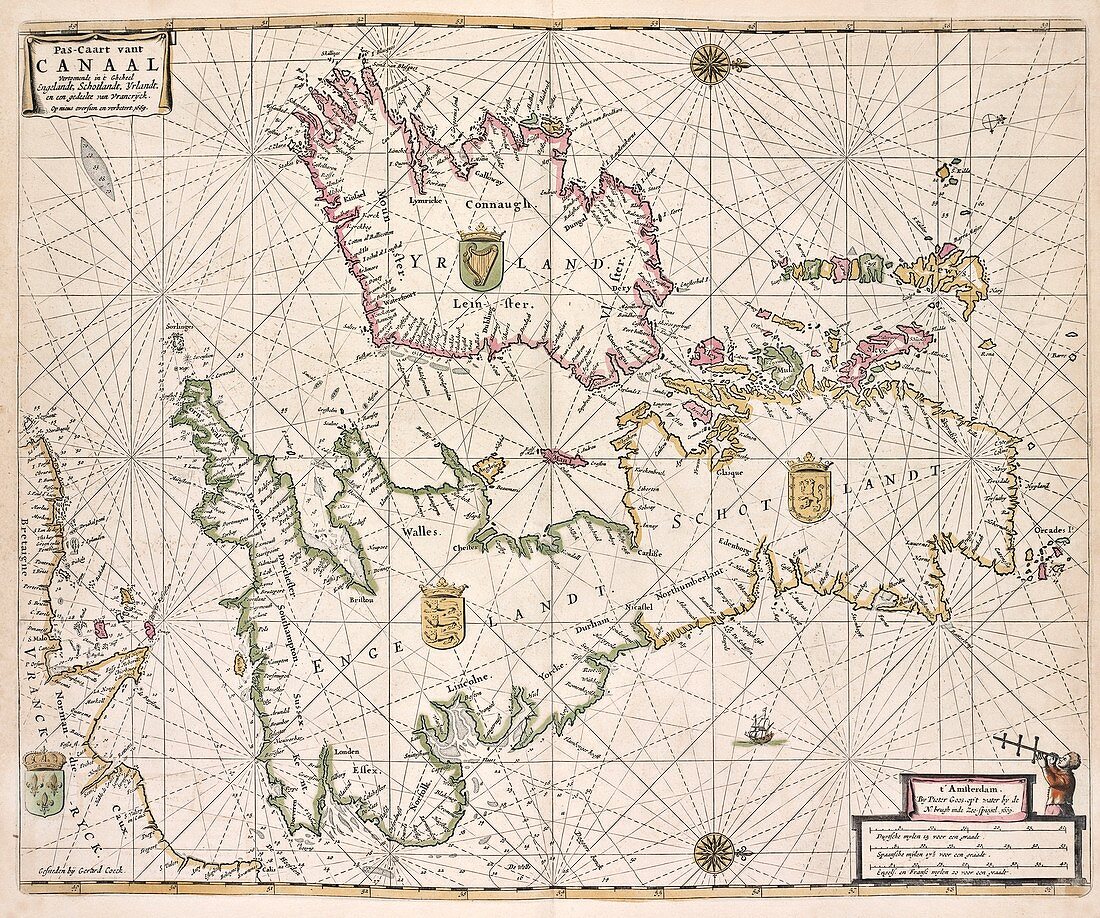
| British Isles. 17th-century map of the British Isles, showing the nations and coats-of-arms for England, Scotland, Ireland and part of the coast of northern France. North is at right. This is a sea-chart, and includes ships, compass roses and rhumb lines. Dated 1669 and titled 'Pas-Caart vant Canaal', this map is by the Dutch cartographer Pieter Goos (1616-1675). It was published in Amsterdam in 1672. The scale at bottom right is in Dutch, Spanish and English and French miles. | |
| Lizenzart: | Lizenzpflichtig |
| Credit: | Science Photo Library / NEW YORK PUBLIC LIBRARY / Lionel Pincus and Princess Firyal Map Division |
| Bildgröße: | 5264 px × 4394 px |
| Modell-Rechte: | nicht erforderlich |
| Eigentums-Rechte: | nicht erforderlich |
| Restrictions: | - |
Preise für dieses Bild ab 15 €
Universitäten & Organisationen
(Informationsmaterial Digital, Informationsmaterial Print, Lehrmaterial Digital etc.)
ab 15 €
Redaktionell
(Bücher, Bücher: Sach- und Fachliteratur, Digitale Medien (redaktionell) etc.)
ab 30 €
Werbung
(Anzeigen, Aussenwerbung, Digitale Medien, Fernsehwerbung, Karten, Werbemittel, Zeitschriften etc.)
ab 55 €
Handelsprodukte
(bedruckte Textilie, Kalender, Postkarte, Grußkarte, Verpackung etc.)
ab 75 €
Pauschalpreise
Rechtepakete für die unbeschränkte Bildnutzung in Print oder Online
ab 495 €