US East coast bomb cyclone, 2018, satellite image
Bildnummer 12446492
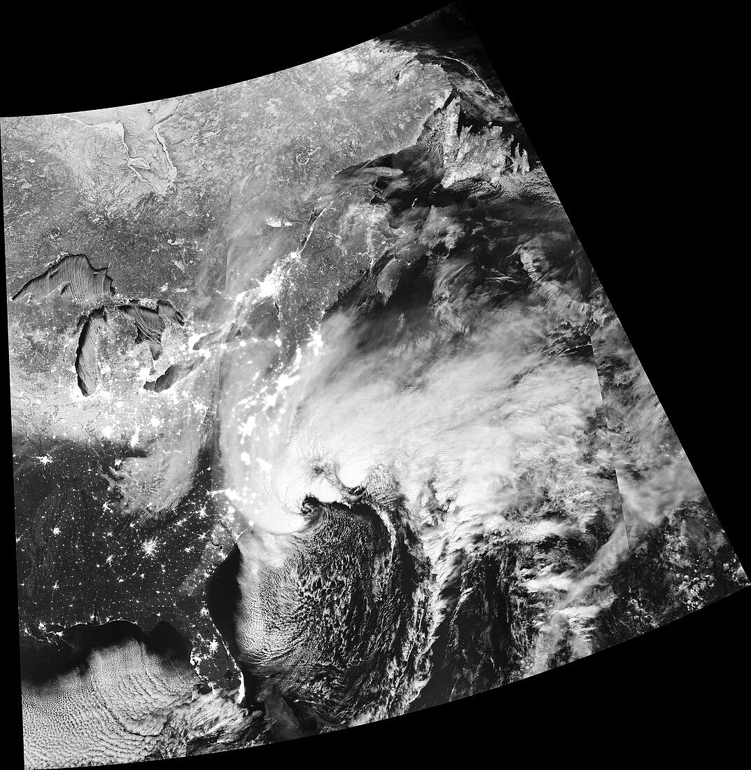
| satellite image of a large storm system off the East coast of the USA in the early morning of 4th January 2018. The storm was undergoing a rapid drop in pressure, dropping over 53 millibars in 21 hours, classifying it as an explosive cyclogenesis, or bomb cyclone. The storm bought freezing temperatures, high winds and large amounts of snow to the East coast of the USA and Canada. The day before this image was taken the storm had moved over Tallahassee, Florida, bringing the first snowfall in three decades. Throughout the storm hundreds of thousands were left without power, thousands of flights were cancelled and 22 people were killed. Data obtained by the Visible Infrared Imaging Radiometer Suite (VIIRS) on the Suomi National Polar-orbiting Partnership (SNPP) weather satellite. | |
| Lizenzart: | Lizenzpflichtig |
| Credit: | Science Photo Library / NASA Earth Observatory |
| Bildgröße: | 5850 px × 5997 px |
| Modell-Rechte: | nicht erforderlich |
| Eigentums-Rechte: | nicht erforderlich |
| Restrictions: | - |
Preise für dieses Bild ab 15 €
Universitäten & Organisationen
(Informationsmaterial Digital, Informationsmaterial Print, Lehrmaterial Digital etc.)
ab 15 €
Redaktionell
(Bücher, Bücher: Sach- und Fachliteratur, Digitale Medien (redaktionell) etc.)
ab 30 €
Werbung
(Anzeigen, Aussenwerbung, Digitale Medien, Fernsehwerbung, Karten, Werbemittel, Zeitschriften etc.)
ab 55 €
Handelsprodukte
(bedruckte Textilie, Kalender, Postkarte, Grußkarte, Verpackung etc.)
ab 75 €
Pauschalpreise
Rechtepakete für die unbeschränkte Bildnutzung in Print oder Online
ab 495 €