Storm Ophelia, satellite image
Bildnummer 12419522
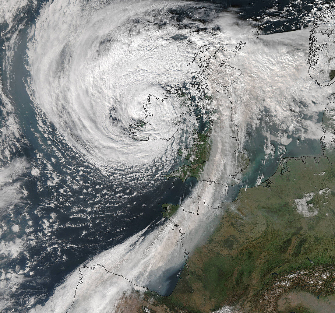
| Panchromatic satellite image of storm Ophelia over the south west coast of the Republic of Ireland just after midday on 16th October 2017. Ophelia developed in the north Atlantic Ocean on 9th October. As it moved north-eastwards towards the Azores the storm strengthened eventually becoming a category 3 hurricane on October 14th. Ophelia made landfall on the south coast of Ireland shortly before this image was taken, with sustained winds of 93 kilometres an hour (km/h) and gusts of 190 km/h. Tens of thousands of homes were left without power and three people were killed. Data obtained by the Visible Infrared Imaging Radiometer Suite (VIIRS) on a Suomi National Polar-orbiting Partnership (SNPP) weather satellite. | |
| Lizenzart: | Lizenzpflichtig |
| Credit: | Science Photo Library / University of Dundee |
| Bildgröße: | 4400 px × 4113 px |
| Modell-Rechte: | nicht erforderlich |
| Eigentums-Rechte: | nicht erforderlich |
| Restrictions: | - |
Preise für dieses Bild ab 15 €
Universitäten & Organisationen
(Informationsmaterial Digital, Informationsmaterial Print, Lehrmaterial Digital etc.)
ab 15 €
Redaktionell
(Bücher, Bücher: Sach- und Fachliteratur, Digitale Medien (redaktionell) etc.)
ab 30 €
Werbung
(Anzeigen, Aussenwerbung, Digitale Medien, Fernsehwerbung, Karten, Werbemittel, Zeitschriften etc.)
ab 55 €
Handelsprodukte
(bedruckte Textilie, Kalender, Postkarte, Grußkarte, Verpackung etc.)
ab 75 €
Pauschalpreise
Rechtepakete für die unbeschränkte Bildnutzung in Print oder Online
ab 495 €