Munster's world map, 1550s
Bildnummer 12362447
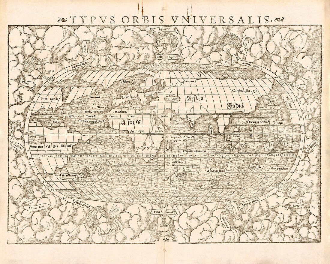
| Munster's world map, 1550s. 16th-century map of the world by German cartographer Sebastian Munster (1488-1552). It is titled in Latin: Typus orbis universalis, and was published circa 1550 in Munster's 'Cosmographia'. The map is decorated with sea monsters and the border contains twelve wind-heads. This was the first map to name the Pacific Ocean (Mare Pacificum). | |
| Lizenzart: | Lizenzpflichtig |
| Credit: | Science Photo Library / LIBRARY OF CONGRESS, Geography and Map Division |
| Bildgröße: | 4724 px × 3780 px |
| Modell-Rechte: | nicht erforderlich |
| Eigentums-Rechte: | nicht erforderlich |
| Restrictions: | - |
Preise für dieses Bild ab 15 €
Universitäten & Organisationen
(Informationsmaterial Digital, Informationsmaterial Print, Lehrmaterial Digital etc.)
ab 15 €
Redaktionell
(Bücher, Bücher: Sach- und Fachliteratur, Digitale Medien (redaktionell) etc.)
ab 30 €
Werbung
(Anzeigen, Aussenwerbung, Digitale Medien, Fernsehwerbung, Karten, Werbemittel, Zeitschriften etc.)
ab 55 €
Handelsprodukte
(bedruckte Textilie, Kalender, Postkarte, Grußkarte, Verpackung etc.)
ab 75 €
Pauschalpreise
Rechtepakete für die unbeschränkte Bildnutzung in Print oder Online
ab 495 €
Keywords
- 1500er Jahre,
- 16. Jahrhundert,
- Afrika,
- Asien,
- Brasilien,
- Einfarbig,
- Europa,
- Florida,
- geografisch,
- Geographie,
- Geschichte,
- historisch,
- Illustration,
- Indien,
- Japan,
- Karte,
- Kartographie,
- Kontinent,
- Kontinente,
- Kunstwerk,
- Niemand,
- Nordamerika,
- Ozeane,
- Pazifik,
- Sansibar,
- Schwarz und weiß,
- Sebastian Münster,
- Sri Lanka,
- Südamerika,
- Weltkarte,
- Wind