Nicaragua Canal, 1870s
Bildnummer 12362443
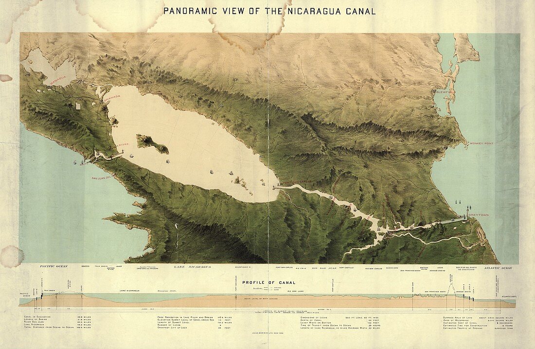
| Nicaragua Canal. 19th-century plan and panoramic view of the Nicaragua Canal. including names of features at bottom with a vertical profile. North is at top. Lake Nicaragua is at centre left. The Pacific coast is at left, and the Atlantic coast at right. Similar to the Panama Canal but much longer, plans for a canal across this region of the isthmus of Central America date from the 1820s. This proposed route, from 1870s, goes from Greytown (right) to Brito (left). The total distance is 169 miles (271 kilometres). This 19th-century proposal failed (it was costed at 100 million US dollars and was estimated to take 6 years to build). A similar modern-day project started in 2014, but it is unclear if it will be completed. Map published in New York by Julius Bien and Company. | |
| Lizenzart: | Lizenzpflichtig |
| Credit: | Science Photo Library / LIBRARY OF CONGRESS, Geography and Map Division |
| Bildgröße: | 6356 px × 4146 px |
| Modell-Rechte: | nicht erforderlich |
| Eigentums-Rechte: | nicht erforderlich |
| Restrictions: | - |
Preise für dieses Bild ab 15 €
Universitäten & Organisationen
(Informationsmaterial Digital, Informationsmaterial Print, Lehrmaterial Digital etc.)
ab 15 €
Redaktionell
(Bücher, Bücher: Sach- und Fachliteratur, Digitale Medien (redaktionell) etc.)
ab 30 €
Werbung
(Anzeigen, Aussenwerbung, Digitale Medien, Fernsehwerbung, Karten, Werbemittel, Zeitschriften etc.)
ab 55 €
Handelsprodukte
(bedruckte Textilie, Kalender, Postkarte, Grußkarte, Verpackung etc.)
ab 75 €
Pauschalpreise
Rechtepakete für die unbeschränkte Bildnutzung in Print oder Online
ab 495 €
Keywords
- 1800er Jahre,
- 19. Jahrhundert,
- Amerikanisch,
- Atlantisch,
- beschriftet,
- Etikette,
- Etiketten,
- Fluss,
- geografisch,
- Geographie,
- Geschichte,
- historisch,
- Illustration,
- Kanal,
- Karte,
- Kartographie,
- Kunstwerk,
- Maritim,
- Mittelamerika,
- Niemand,
- Panoramablick,
- Pazifik,
- San Juan River,
- See,
- Text,
- Transport,
- uns,
- Wasserweg,
- Zentralamerika