Global soil moisture, SMAP satellite map
Bildnummer 12257729
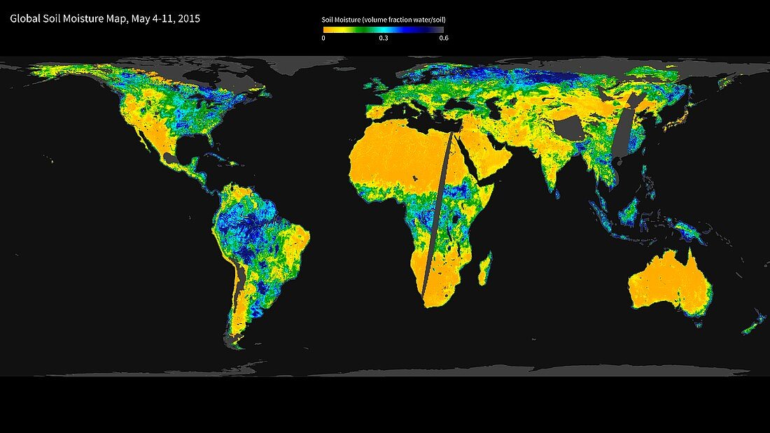
| Global soil moisture. Satellite map showing the global variation in soil moisture, combining radar and radiometer sensor data. The moisture levels range from low (yellow) though green and light blue to high (green). The data is from the NASA satellite, the Soil Moisture Active Passive (SMAP) observatory. SMAP was launched on 31 January 2015, and these results from 4-11 May 2015 were among the first results from its observations. SMAP will combine two different sensor modes (radar and radiometer) to produce a combined soil moisture measurement. For the first radiometer map, see C032/1706. For the first radar map, see C032/1707. | |
| Lizenzart: | Lizenzpflichtig |
| Credit: | Science Photo Library / GFSC / JPL-Caltech / NASA |
| Bildgröße: | 5634 px × 3169 px |
| Modell-Rechte: | nicht erforderlich |
| Eigentums-Rechte: | nicht erforderlich |
| Restrictions: | - |
Preise für dieses Bild ab 15 €
Universitäten & Organisationen
(Informationsmaterial Digital, Informationsmaterial Print, Lehrmaterial Digital etc.)
ab 15 €
Redaktionell
(Bücher, Bücher: Sach- und Fachliteratur, Digitale Medien (redaktionell) etc.)
ab 30 €
Werbung
(Anzeigen, Aussenwerbung, Digitale Medien, Fernsehwerbung, Karten, Werbemittel, Zeitschriften etc.)
ab 55 €
Handelsprodukte
(bedruckte Textilie, Kalender, Postkarte, Grußkarte, Verpackung etc.)
ab 75 €
Pauschalpreise
Rechtepakete für die unbeschränkte Bildnutzung in Print oder Online
ab 495 €